Map

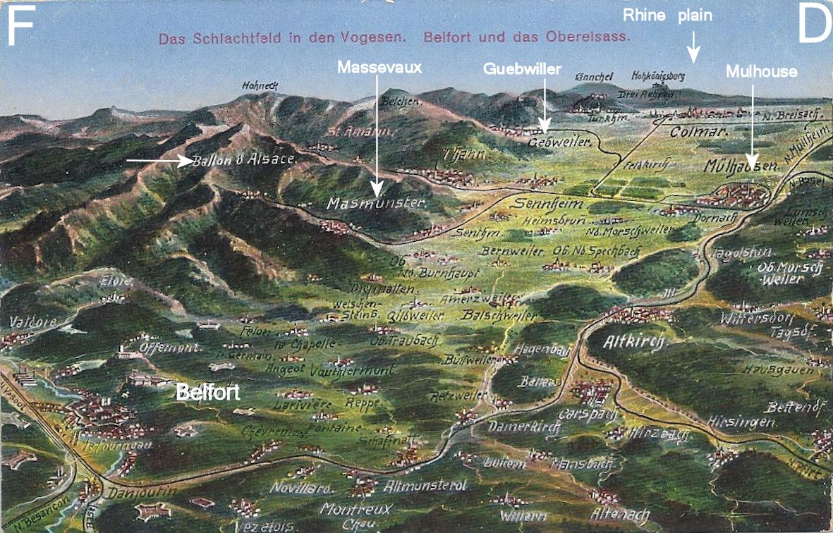
By way of orientation, here’s an annotated “bird’s eye” map showing the Ballon d’Alsace. These cards were very popular among soldiers writing home from the Front. Most of mine are German and the place names used are those which replaced the French names during the period of occupation.

Picture map Belfort labelled


A contemporary map

This is an extract from a larger map, unfortunately undated, showing  Elsaß Lothringen.

Elsass Lothringen map extract

 Towns and villages were given German names. Examples, working south:

Strassburg or Straßburg is Strasbourg

Schlettstadt is Sélestat

Markirch is Ste-Marie-aux-Mines

St Pilt is St-Hippolyte

Rappoltsweiler is Ribeauvillé

Münster is Munster

Gebweiler is Guebwiller

Sulz is Soultz

Sennheim is Cernay

Mulhausen is Mulhouse

(I have a directory of German placenames and am happy to give other translations.)

Debout les Morts!

Bringing the French experience of the First World War on the Western Front to English language speakers

WW1 Revisited

A Great War Journey with Paul Reed

Lordynges, Lystenyth

Children's stories lovingly adapted into Middle English verse by Hollie L. S. Morgan

midasinreverse: ian o'brien

Poetry, thoughts, rants by @OB1Ian

In That Rich Earth...

Great War History - reviews & articles

Expériences étrangères

Expériences étrangères

WW1 Centenary

Great War Centenary 2014-2018 website by Paul Reed

halfmuffled

Looking at the members of the Surrey Association of Church Bell Ringers who served in the First World War, and closely related matters

Blindfold and Alone

The trials of British Soldiers convicted in Capital Courts Martial during the Great War

%d bloggers like this: