How a cow changed the fortunes of a village

Legend says that in 1603, a heifer discovered a mineral water source in Soultzbach les Bains, in the vallée de Munster!

Visitors had been bathing at Soultzbach les Bains for four hundred years before Alsace became part of the new German Empire. In fact, they were doing so before the fortuitous wanderings of the local heifer. Jacques de Hattstatt, seigneur, established a Badehus in the fifteenth century and after the Hattstatt line died out in 1585, the village came into the ownership of the barons Schauenburg Herrlisheim, who set about installing the means of exploiting the mineral water source. There are records of a possibly seventeenth century hall with a basin for the collection of water, at least one room for people seeking a cure, and a dwelling; there are records showing that after the Schauenbergs sold the premises to a M Bobenrieth in 1815, there is another wing.

M Bobenrieth saw the commercial potential for selling health-giving waters and he collected the spring water in pitchers for sale. At the same time, the popularity of the source was attracting large numbers of tourists into the village, where they lodged, until disaster struck: a large fire, which reduced the accommodation available.

By this time, a Swiss industrialist called M de Gonzenbach had bought the premises. He halted the activity at the source and reconsidered. He decided that the source was to become a thermal hotel, with an extra floor added to the building, a new wing built for entertainment of the guests and the garden transformed into an agreeable pleasure park. By 1854, there were up to 200 ‘patients’ taking the waters and enjoying the delights of a smart hotel in beautiful mountainous surroundings with invigorating fresh air and plenty of opportunities for gentle exercise should they be so minded.
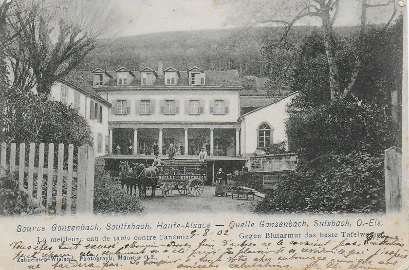
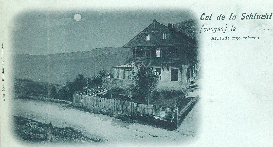
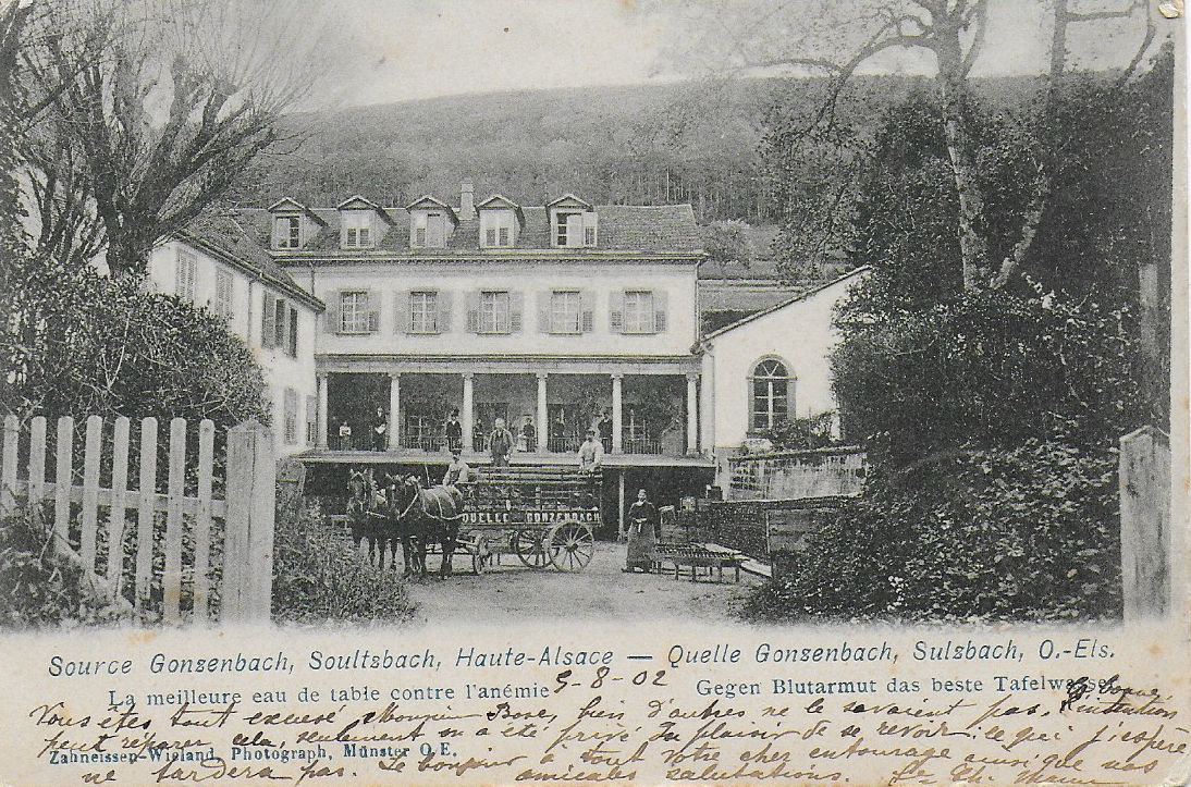
Soultzbach source Gonzenbach - spa 1902

Postcard sent 1902

Alongside the hotel business, M de Gonzenbach’s commercial acumen prompted him to develop the external sales of water. It was sold under the name Source Gonzenbach and by 1863, sales reached 49171 bottles and jugs.

Soultzbach source Gonzenbach rear

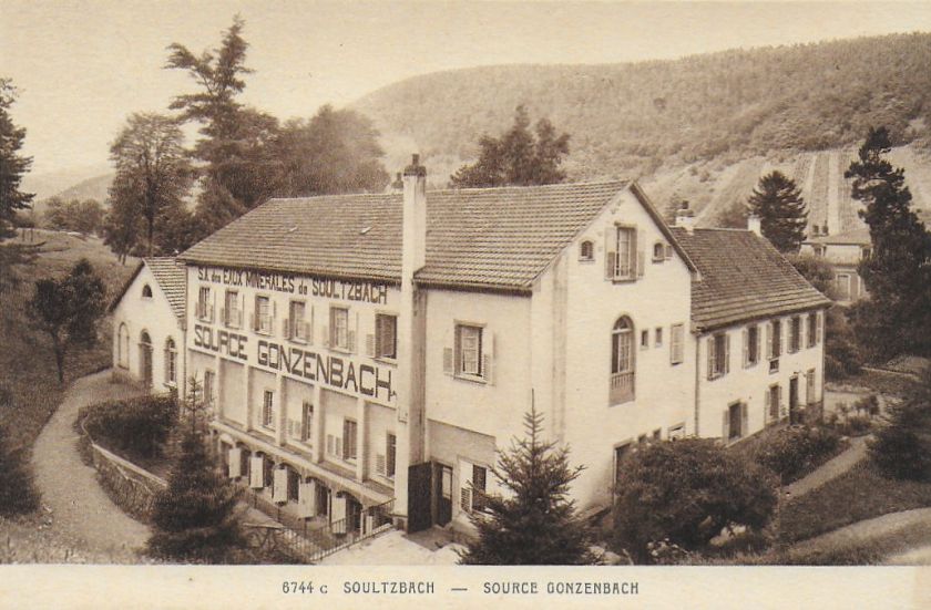
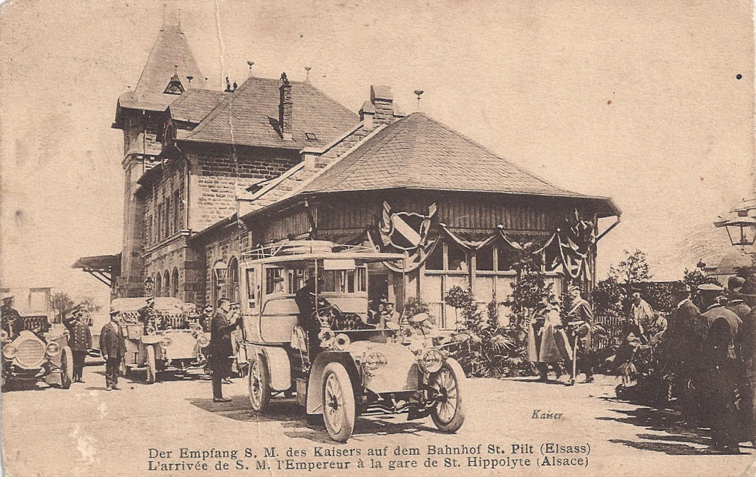
Postcard view of the rear – casino wing on left

The business was sold on by M de Gonzenbach’s son-in-law but the new owner suffered financial ruin after the Great War and he ceded the source to the water company Carola of Ribeauvillé. (Carola still exists and is a prominent supplier of bottled water in the region.) Over the next few years, Carola mechanised the water collection and built bottling units, but the cramped location restricted development. Perrier-Nestlé bought the source and ceased operations there in 1993. From the meanderings of a village cow to a multinational company in four centuries!

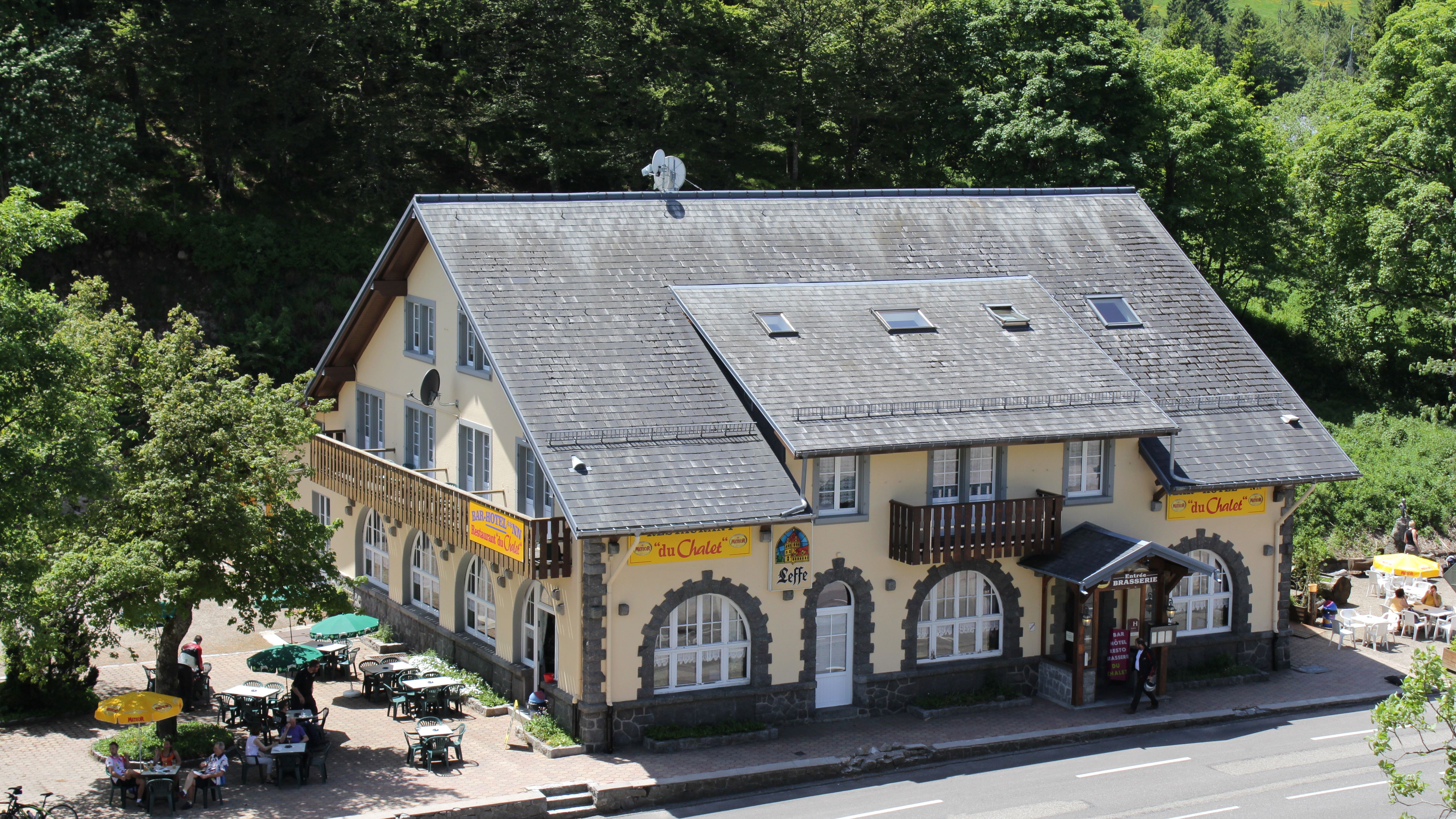
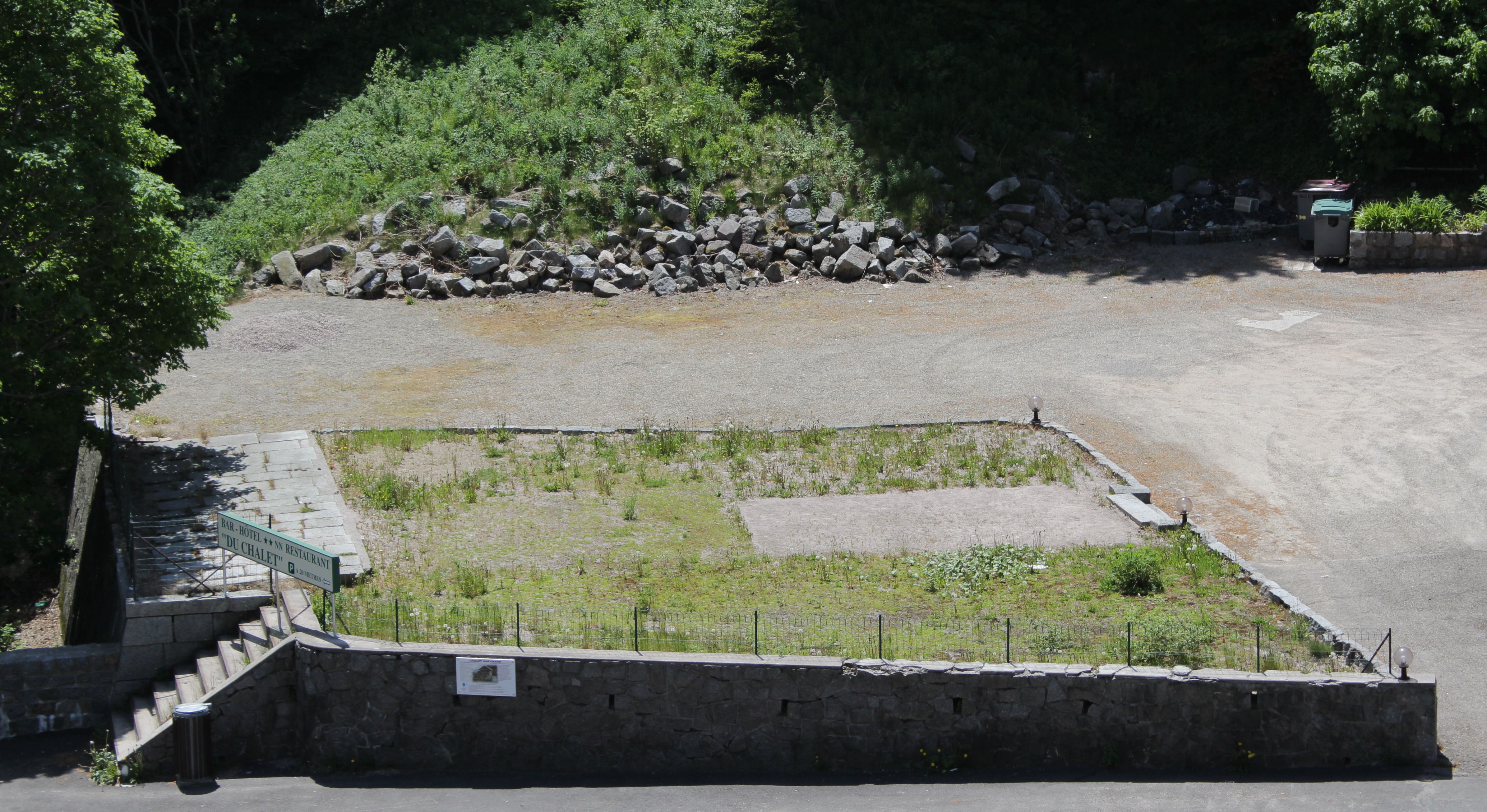
The premises are now in private ownership and the industrial units have been removed. My photo shows two wings and the main building forming a courtyard. According to Inventaire général du patrimoine culturel* the ground floor and first floor correspond with the original building. The right wing was the casino.

Gonzenbach now

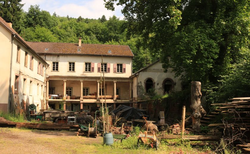
We particularly noticed the columns with Doric capitals and the entablature with frieze with gryphons.

Gonzenbach gryphons and frieze

The south wing used to contain the casino and looking at the elegant arched windows, it doesn’t take much imagination to people the room with elegant fashions and animated conversations.

Gonzenbach casino window smaller

I am very grateful to the current owner who allowed us to wander around and take photos after we chanced upon this wonderful building in a quiet part of Soultzbach. I’m sure the disused hotel Au Relais de la Source across the road from the thermal hotel has its own stories, too.


Au Relais de la Source


References:

*http://www.culture.gouv.fr/culture/inventai/patrimoine/

Des usines au fil de la Fecht: Le patrimoine industriel de la vallée de Munster, editions LieuxDits, 2008

My photos and postcards


L’église de l’Emm, Mémorial de la Première Guerre mondiale: a post for 11th, 11th, 2014.

La Chapelle d’Emm, Metzeral – a memorial to those who died in the Vosges

Please visit A gallery of images 

L’église de l’Emm takes its name from Emma, niece of Charlemagne, who founded a hermitage on this colline near Metzeral in memory of her fiancé, Roland de Roncevaux, in the fifteenth century. Through the next five centuries, the original chapel was variously destroyed, rebuilt, rededicated, refounded and eventually wrecked in the Battle of Metzeral (15th – 21st June, 1915).

00 Metzeral Chapelle Emm

After the war, the ancient chapel stood in ruins. Curate Martin Behe arrived in the Fecht valley in 1921 and was deeply affected by the damaged valley, dreadfully scarred by warfare and the resting places for thousands of French soldiers, some in the cemeteries and some lost possibly forever in the mountainous landscape of the Vosges. He urged the construction of a memorial.

The colline was designated as the site for a church consecrated to the memory of the soldiers who fell in the Vosges, particularly those who died in the battle for Metzeral and who still lie in the Vosges. It was to be a focus for families to remember their husbands, their fathers, their sons, their neighbours, and people were encouraged to contribute. The site of the old chapel was chosen and a new church was built as église-mémorial de l’Emm. It is an expression of mourning and of gratitude by the people of Alsace.

The project was overseen by a committee under the banner Souvenir Alsacien, which included the bishop of Strasbourg and General Pouydraguin. Fundraising took place across France and abroad. The builders used local red sandstone (the same as was used for the cathedral in Strasbourg) and prominent on the façade is the inscription expressing the gratitude of Alsace: “À nos vaillants soldats, l’Alsace reconnaissante”.

26 A nos vaillants 2014

The building was finally dedicated on October 4th, 1931 and the bells were dedicated nine months later in July 1932. I believe the bell tower contains four bells. One is intended to evoke the majestic sound of the bell in the ossuary at Douaument.

Inside, the walls are lined with 1.80m high marble panels, each engraved with the names of the soldiers who died in the battle for Metzeral. Stained glass windows throw their saturated light on to the light marble. It is a profoundly peaceful place which encourages reflection. One window depicts a chaplain ministering to a dying comrade among the debris and flashing lights of the battlefield. It is called, simply, ‘Nos morts’.

16a Emm poilus closeup

Gallery of images

Note 1: The Battle of Metzeral (1915)

Metzeral is 6.5 km west of Munster, in the valley of the river Fecht. Control of the valley was important for both sides and military operations took place there early in 1915, coinciding with the intense fighting at Hartmannswillerkopf. The battle for Metzeral in June 1915 tends to be overshadowed by the bitter struggle for Hartmannswillerkopf and (beginning just one month later) the fierce battle at le Linge, but it was important and deadly.

The combined forces of Major General Pouydraguin (47th Division) and General Serret (66th division) were deployed to remove the enemy from the upper valley of the Fecht. Initially they were unsuccessful and the two generals decided to carry out a major assault.

The populations of the villages or Metzeral and Sondernach were evacuated on June 9th and the attack began on June 15th. The main action took place on 20th and 21st June, with heavy fighting street by street, building by building, hand against hand, bayonet against bayonet. The village was ruined beyond recognition, the tranquil river valley destroyed. By the 24th June, the French had secured Metzeral but the human cost was devastating. The French cemeteries of Chêne Millet and Sondernach, the German cemetery of Breitenbach, are witness to the losses in the valley of the Fecht.

Note 2:

I have photographed all the panels, but I have not transcribed them. All the names can be found here: http://www.amisdelemm.fr/images/sampledata/Documents/plaques_votives.pdf

Please visit the gallery of images

Chalet Hartmann: romance to ruins in 90 years

Approaching the summit of Col de la Schlucht (1139m) from the Munster valley, one of the first signs of habitation is the Hotel du Chalet. For decades travellers have refreshed themselves and relaxed here: cyclists and walkers –

Schlucht Hotel du Chalet

motorists –

Col de la Schlucht Hotel du Chalet with people & cars

and skiers –

Col de la Schlucht Hotel du Chalet with skiers

Adjoining the hotel premises is a patch of gravelly ground with a set of stone steps leading up to what looks like the foundations of a building. The excursionists of the Occupation era would have seen a pretty Swiss-style building called Chalet Hartmann here (seen in the second postcard above) and might possibly even have crossed paths with a distinguished visitor.

Col de la Schlucht 11 septembre 1908 après arrivée de l'Empereur Guillaume

1908 – crowds linger after the arrival of Wilhelm II and his entourage. The dark building on the left is the German customs building.


Chalet Hartmann was built in 1859/60 by a prominent industrialist, Frédéric Hartmann-Metzger, known for his fabric factories in Munster and his benevolent treatment of his staff, including establishing schools in the valley. He constructed the Chalet to mark the completion of the steep, winding road up to the Col from Munster begun fifteen years earlier.

Col de la Schlucht Chalet Hartmann day scene Before the Great War

Many illustrious people visited it, including Napoléon III (twice before the war of 1870) and Wilhelm II in September 1908. With Alsace returned to German territory, Hitler visited la Schlucht in 1940.

Col de la Schlucht Chalet Hartmann Kaiser visit query 28.07.1909 1908 (Unfortunately the original card is blurred.)

For part of its life, Chalet Hartmann was a restaurant popular with celebrities. It was badly damaged in the Great War, abandoned in the 1930s, and then damaged again in the Second World War. In 1946 it was completely demolished.

Col de la Schlucht Chalet Hartmann ruined A sad sight after the Great War

This is what the once beautiful Chalet Hartmann looks like now, photographed from the footpath which climbs behind the semi-derelict Hotel Tetras and overlooks the site of the original German customs building. All that remains is the set of steps into the house.

Chalet Hartmann site

The époque of a rather elegant, leisured, somewhat romantically inclined tourist industry was over and la Schlucht began to look for modern ways of exploiting the white gold of the high mountains.

Col de la Schlucht Chalet Hartmann


(All postcards and photographs are my own. Modern photographs June 2013)


Royal travels (an occasional look at the various Kaisers’ visits to Elsaß-Lothringen*)

One of the first public buildings built by the new Reichsland authority was the fine central station in Strasbourg (1883), designed by Jacobstahl, an architect from Berlin. In the departure hall, two fabulous gold-framed murals by Knackfuss celebrated the integration of Alsace and Lorraine into the Empire while reminding the traveller of a past period of unity.

One depicted the arrival of Emperor Friedrich I Barbarossa in Haguenau in 1164, the year he awarded a city charter to this small town which he had fortified and where he had chosen to site his imperial residence. Haguenau (Hagenau in German) is north of Strasbourg. “Im alten Reich”

Visit of Kaiser Barbarossa 1164 Hagenau

The other shows Kaiser Wilhelm I and Crown Prince Friedrich arriving in Strasbourg in 1877 to inspect fortifications. “Im neuen Reich”

Visit of Kaiser & Crown Prince to Strasbourg 1877 posted 1910

(Above: Card posted April 1908. The two women in the centre welcoming him are wearing regional costumes of Alsace and Lorraine.)

The murals were an assertion of historic unity and German authority. Naturally, they were taken down when the city was restored to France and I believe they are lost. The SNCF station now includes the TGV hub.

The arrival of Kaiser Wilhelm II at a station clearly involved flags, bunting, grand motor cars and assorted worthies. Here he is making his way to a car at the station of the small wine-growing village of St-Hippolyte (St Pilt in German).

St-Hippolyte Emperor arrival at station posted Aug 1912 (Card posted August 1912)

The station is now derelict and rather intimidating with large barking dogs roaming the grounds. I photographed it almost exactly one hundred years later in July 2012.

St-Hippolyte station July 2012 35cm

The card gives no indication about where the Kaiser and his entourage were travelling to, but St-Hippolyte is very convenient for his castle, Hohkönigsburg, in French Haut-Kœnigsbourg, which overlooks St-Hippolyte and the surrounding villages and vineyards. When Kaiser Wilhelm II took ownership of Hohkönigsburg, it was in ruins after fires and failed restoration projects. The nearby town of Sélestat owned the castle but, unable to fund its reconstruction, it offered to the Kaiser in 1899.

Haut Koenigsburg Hoh-Konigsburg Hotel mit ruines (Before – castle ruin at the summit)

Haut Koenigsburg posted 1901 (Before – card posted 1901)

After:

Haut Koenigsburg posted pre WW1

The potential to restore a fabulous castle on a magnificently prominent site was irresistible and Wilhelm II embarked on an ambitious project which would signal to all that Alsace was again part of the Empire. Between 1900 and 1908 this potent political symbol was painstakingly rebuilt in the style of a fifteenth century mountain fortress. Like the station in Strasbourg, it was yet another public building powerfully reinforcing the vision of Alsace aligned within his Empire – permanently.

Today it is an immensely popular tourist attraction: vast numbers of visitors go there each year. For this reason, I have not been inside Haut-Kœnigsbourg: I consider it’s best viewed from a distance.

Haut Koenigsburg sunset 35cm (Left and below, photographed from St-Hippolyte)

Haut Koenigsburg sunset 2

Wilhelm II never lived at Haut-Kœnigsbourg: I believe he never intended to. Locally it was a much criticised symbol of distrust and dislike. Even the pageant of its official opening took place in a deluge. It was not entirely finished in his reign: within five years of its completion, the storms of war were breaking across Europe.

Lightning

( Storm, June 2012. St-Hippolyte church lit up; Haut-Kœnigsbourg on top of hill to right)

All postcards and photographs my own.

*Note: Elsaß-Lothringen – Alsace and Lorraine

More historical information on the Haut-Kœnigsbourg website: http://www.haut-koenigsbourg.fr/

Debout les Morts!

Bringing the French experience of the First World War on the Western Front to English language speakers

WW1 Revisited

A Great War Journey with Paul Reed

Lordynges, Lystenyth

Children's stories lovingly adapted into Middle English verse by Hollie L. S. Morgan

midasinreverse: ian o'brien

Poetry, thoughts, rants by @OB1Ian

In That Rich Earth...

Great War History - reviews & articles

Expériences étrangères

Expériences étrangères

WW1 Centenary

Great War Centenary 2014-2018 website by Paul Reed

halfmuffled

Looking at the members of the Surrey Association of Church Bell Ringers who served in the First World War, and closely related matters

Blindfold and Alone

The trials of British Soldiers convicted in Capital Courts Martial during the Great War

%d bloggers like this: