Exploring la Tête des Faux

I was asked to write a piece in memory of David O’Mara, a talented but unassuming military historian who was much respected and held in great affection by many. One of his passions was the Vosges. He died suddenly, far too young, in 2022. I chose to invite the reader to explore the mountain battlefield of la Tête des Faux because David enjoyed walking there.

It’s intended for people who aren’t familiar with either the Vosges battlefields or the military operations in the Vosges, so it’s user-friendly, I hope.

The ‘photo of the month’ of the forest graveyard Rabenbühl seems rather strange in the middle because it crosses the gutter.

(Please click on the hyperlink below the .pdf to view the pages clearly.)

Since the piece was published, Martin Rupp has informed me that there were actually three small German cemeteries on la Tête des Faux besides Hexenweiher and Rabenbühl: Oberer, Mittlerer and Unterer Friedhof. They were in the upper part of the fortress area. The burials in Mittlerer were relocated to Hexenweiher and the others remained until the end of the war.

The stelae at Hexenweiher “are actually tombstones as – remarkably – the cemetery contained not a single mass grave in the classical sense. Even where multiple soldiers were buried in one grave they were buried side-by-side, identified and clearly listed. From 1915 on, there were large efforts made to identify as many soldiers as possible and to rectify errors made during the recordings of the burials. Names were checked, units which left the area contacted for input and corrections. In total there were maybe like 5 or so “unknown” burials on the entire Buchenkopf [la Tête des Faux].

“The reason for this is probably that the Germans who died on the attack (in 1914) fell into French hands while everybody else who died from 1915 on died within the perimeter of the Buchenkopf Fortress and could therefore be identified and properly buried. That’s one of the few ‘advantages’ of this position as there was no movement of the frontline after 1914. Contrary to , for example, the Hartmannsweilerkopf where individual positions were taken and lost till much later. As one has to admit though, there were several mass graves for French soldiers which remained unidentified.”

Thank you to Martin Rupp for the interesting extra information.

Above: Hexenweiher

Above: Rabenbühl. Some of these stelae remain in the former cemetery and can be clearly identified.

Featured photo (top of page): Cimetière Duchesne

Location: La Tête des Faux is in Haut-Rhin, south of the village of le Bonhomme, west of Lapoutroie and north east of Lac Blanc.

~~~~~~~~~~~~~~~~~~~~~~~~~~~~~~~~~~~~~~~~~~~~~~~~~~~~~~~~~~~~~~~~~~~~~~~~~

Salient Points magazine, November 2022

greatwargroup.com

Text, photographs and contemporary picture images are mine.

April 1915: “Poisson d’Avril” & “Heureuses Pâques”

Poisson d’Avril

Even in war conditions, in an atmosphere which was far from funny, the French soldier might recall the absurd, fun tradition of poisson d’Avril (where a child sticks a paper fish on a victim’s back as an April Fool’s Day trick) by sending a postcard. This one has a particularly patriotic theme: Alsace personified is tied to a tree somewhere in recognisably Alsacien mountain terrain. However, an heroic French soldier is appearing riding a fish to her rescue. The fish’s colours of red and white, combined with his blue, signify patriotism. A German soldier is just seen skulking away. The image is ludicrous but the message is hopeful and serious: “Dearest Alsace! Liberty at last!”

This card from my collection was posted on 1st April 1915.

Patriotic Poisson d'Avril posted 1.4.1915


Easter

As far as possible, French soldiers marked Easter, though tinged with sadness; many fathers took the opportunity to send postcards or letters to their children to show that they were thinking of them, and cards were sent to and by their loved ones. Sometimes Christian services were possible, with music, hymns and communion.

Many cards have a patriotic, propaganda flavour. In this one, the tradition of Easter eggs is surreally taken further and to the soldiers’ delight, the egg cracks open to reveal Alsace (with the black coiffe) and Lorraine (in the lace cap). They are clutching the French flag and Alsace’s dress is tinged with the French colours red, white and blue. The message in the bottom left hand corner is Revanche: revenge, the return of the lost territory, and the cheering soldiers reflect the anticipated joy when the two regions will be restored to France.

This card was sent in April 1915 by two friends to Bruno who was serving at sea. As far as I can find out, he survived the war.


Patriotic Hereuses Pâques sent 1915

Defiance, resolution, inspiration: Jeanne d’Arc on memorials in Alsace

Breitenbach Bas Rhin Jeanne 2

In 1431 a young peasant girl from Domrémy in the Vosges was burned alive after an illegal trial for heresy in Rouen. During the period in which Alsace and Lorraine were part of the German Empire, she became a powerful symbol of resistance, of defiance, of eagerness for liberation

TBreitenbach Bas Rhin Jeanne 1he inspirational figure of Jeanne or Jehanne d’Arc is a recurrent theme in monuments and memorials after the Great War.  In the memorial in the rural village of Breitenbach, Bas-Rhin,  [above and left], Jeanne stands alone.

Many Alsacien men were forced to fight for Germany, although anyone under the age of 43 when war was declared in 1914 had not known life as a French citizen and Alsacien men in the German army had grown up as Germans. Nevertheless, the theme of a young man being forced to fight for the oppressor is a powerful one and many patriotic and propaganda images depict the despair of the young soldier and his family.

The woman depicted on the war memorial at Guebwiller [previous blog post] pins a small rosette on a young man’s chest under his jacket and tells him, “Remember you are French.” These rosettes were red, white and blue (the colours of the French flag). The memorial at Rosheim shows a French poilu offering the open hand of friendship to a young man who has opened his jacket to reveal the patriotic rosette over his heart; his enforced pickelhaube has been discarded at his feet and Jeanne embraces the two in a gesture which emphasises harmony and unity restored between France and her lost départements.

Rosheim Jeanne

The inspiration of Jeanne in times of oppression and war is reflected in her use in cemeteries. The village and community of Plaine, north of Saales, suffered dreadfully in the raging combats of August 1914 as each side fought to gain control of the essential cols. Jeanne was erected in this cemetery on 12th August 1923. The base of the statue says, “À eux l’immortalité, à nous le souvenir.”

Plaine cimetière militaire

Plaine Jeanne

Menil-sur-Belvitte is a large 1917 nécropole nationale south of Baccarat and it is the resting place of a thousand men, many casualties from the Bataille de la Mortagne (August 1914) and the ghastly fighting at Col de la Chipote. Opposite the cemetery, peacefully surrounded by pastures with the characteristic Vosgienne cows, is a memorial privately erected in 1927 by l’Abbé Collé, the village curé. He also established a small commemorative museum which was destroyed by German troops in 1944.

Menil Jeanne 1

The essential figures on this memorial are in gold; one is Jeanne (“custos patriae”) at the pinnacle and the others (in what seems like slightly toned down gold) are the brave heroes of the 13th, 14th 15th and 21st Corps d’Armée 1914.

Poilus

It is a memorial of unexpected height and power; the loyal Chasseur figures, bravely ready for any challenger and cared for in death by a despairing figure of Mary, demand attention. Jeanne’s immense elevation, her raised cruciform sword and her striking gold armour communicate as a symbol of defiance and inner strength. Your eye is drawn upwards from the brave soldiers to their alleged inspiration as they fought to regain Alsace and Moselle for France.

Jeanne d'Arc, Ballon d'Alsace
Jeanne d’Arc, Ballon d’Alsace

Note:

Le cimetière militaire Plaine also includes a small plot containing the remains of 40 British casualties from the Great War. It is in the far left hand corner of my photograph.

Much of this text has been adapted from a previous blog post. It is published here in the period of Remembrance.

L’église de l’Emm, Mémorial de la Première Guerre mondiale: a post for 11th, 11th, 2014.

La Chapelle d’Emm, Metzeral – a memorial to those who died in the Vosges

Please visit A gallery of images 

L’église de l’Emm takes its name from Emma, niece of Charlemagne, who founded a hermitage on this colline near Metzeral in memory of her fiancé, Roland de Roncevaux, in the fifteenth century. Through the next five centuries, the original chapel was variously destroyed, rebuilt, rededicated, refounded and eventually wrecked in the Battle of Metzeral (15th – 21st June, 1915).

00 Metzeral Chapelle Emm

After the war, the ancient chapel stood in ruins. Curate Martin Behe arrived in the Fecht valley in 1921 and was deeply affected by the damaged valley, dreadfully scarred by warfare and the resting places for thousands of French soldiers, some in the cemeteries and some lost possibly forever in the mountainous landscape of the Vosges. He urged the construction of a memorial.

The colline was designated as the site for a church consecrated to the memory of the soldiers who fell in the Vosges, particularly those who died in the battle for Metzeral and who still lie in the Vosges. It was to be a focus for families to remember their husbands, their fathers, their sons, their neighbours, and people were encouraged to contribute. The site of the old chapel was chosen and a new church was built as église-mémorial de l’Emm. It is an expression of mourning and of gratitude by the people of Alsace.

The project was overseen by a committee under the banner Souvenir Alsacien, which included the bishop of Strasbourg and General Pouydraguin. Fundraising took place across France and abroad. The builders used local red sandstone (the same as was used for the cathedral in Strasbourg) and prominent on the façade is the inscription expressing the gratitude of Alsace: “À nos vaillants soldats, l’Alsace reconnaissante”.

26 A nos vaillants 2014

The building was finally dedicated on October 4th, 1931 and the bells were dedicated nine months later in July 1932. I believe the bell tower contains four bells. One is intended to evoke the majestic sound of the bell in the ossuary at Douaument.

Inside, the walls are lined with 1.80m high marble panels, each engraved with the names of the soldiers who died in the battle for Metzeral. Stained glass windows throw their saturated light on to the light marble. It is a profoundly peaceful place which encourages reflection. One window depicts a chaplain ministering to a dying comrade among the debris and flashing lights of the battlefield. It is called, simply, ‘Nos morts’.

16a Emm poilus closeup

Gallery of images

Note 1: The Battle of Metzeral (1915)

Metzeral is 6.5 km west of Munster, in the valley of the river Fecht. Control of the valley was important for both sides and military operations took place there early in 1915, coinciding with the intense fighting at Hartmannswillerkopf. The battle for Metzeral in June 1915 tends to be overshadowed by the bitter struggle for Hartmannswillerkopf and (beginning just one month later) the fierce battle at le Linge, but it was important and deadly.

The combined forces of Major General Pouydraguin (47th Division) and General Serret (66th division) were deployed to remove the enemy from the upper valley of the Fecht. Initially they were unsuccessful and the two generals decided to carry out a major assault.

The populations of the villages or Metzeral and Sondernach were evacuated on June 9th and the attack began on June 15th. The main action took place on 20th and 21st June, with heavy fighting street by street, building by building, hand against hand, bayonet against bayonet. The village was ruined beyond recognition, the tranquil river valley destroyed. By the 24th June, the French had secured Metzeral but the human cost was devastating. The French cemeteries of Chêne Millet and Sondernach, the German cemetery of Breitenbach, are witness to the losses in the valley of the Fecht.

Note 2:

I have photographed all the panels, but I have not transcribed them. All the names can be found here: http://www.amisdelemm.fr/images/sampledata/Documents/plaques_votives.pdf

Please visit the gallery of images

Le Col de la Chipotte, 25th August 1914 – le Trou d’Enfer, the Hell Hole

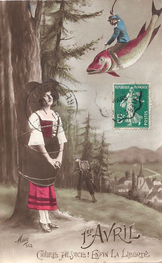
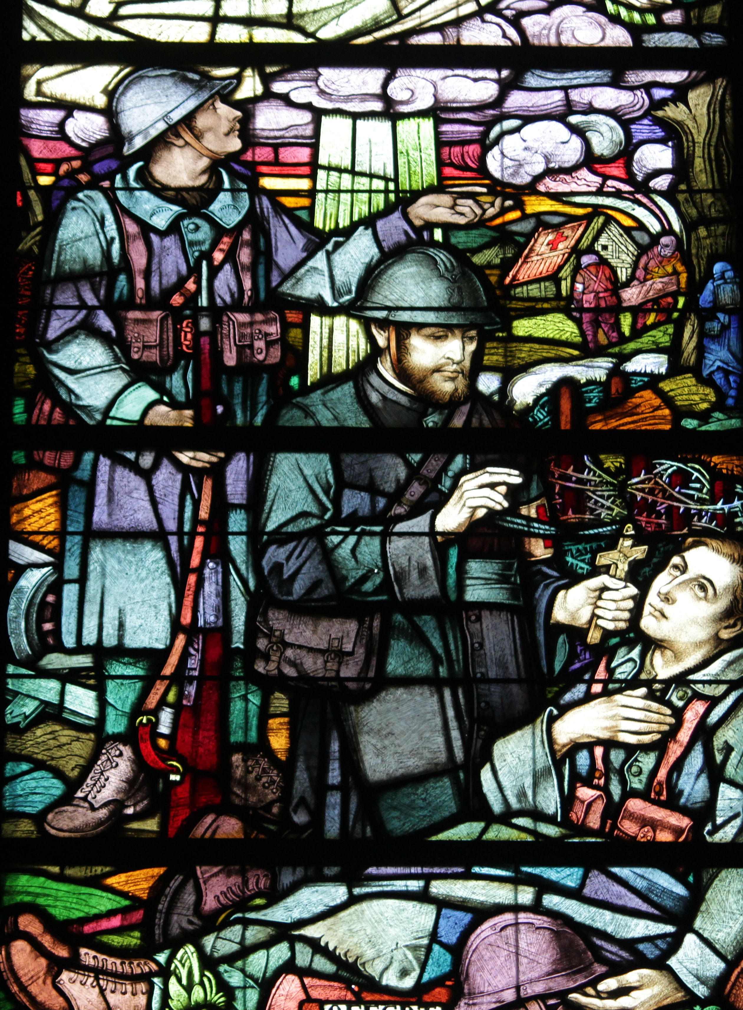
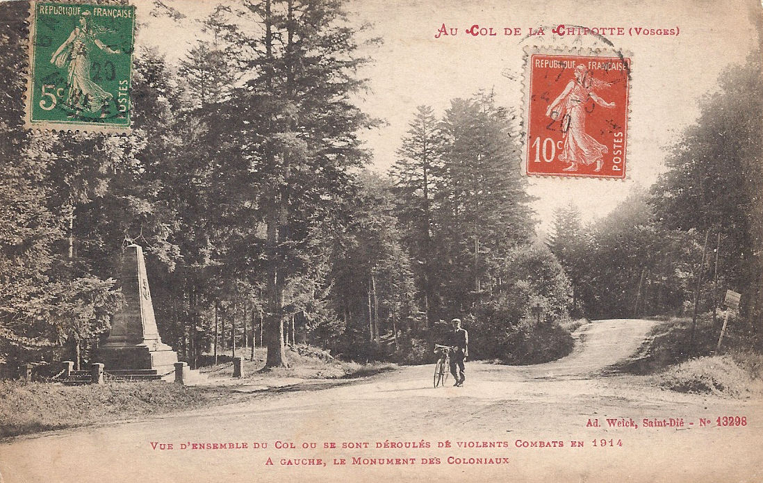
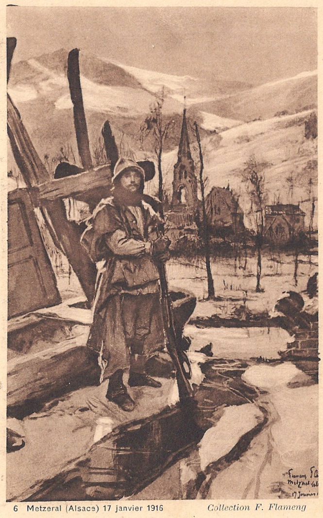
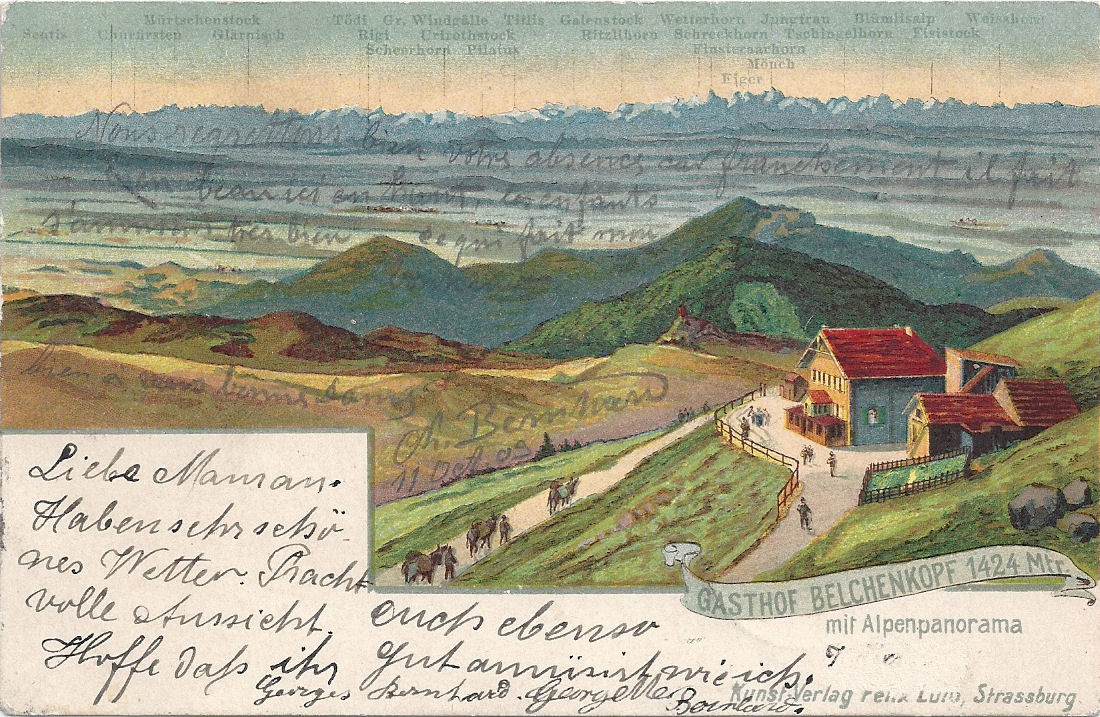
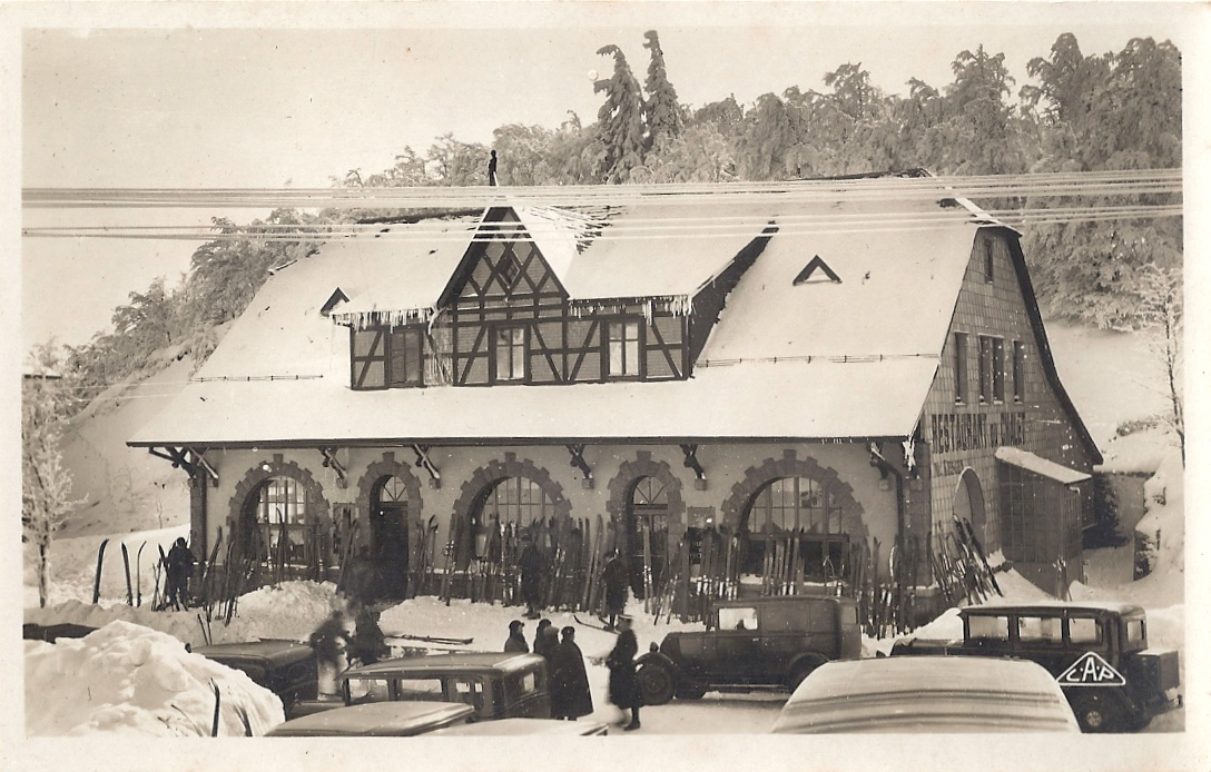
Le Col de la Chipotte, 25th August 1914 – le Trou d’Enfer, the Hell Hole . Current thinking is that the soldiers on both the French and the German sides fought for the Col de la Chipotte with courage, endurance and determination. Many were inexperienced in mountain and forest combat, and the nature of the terrain undoubtedly contributed to the huge losses and injuries on both sides. One of my postcards of le Col de la Chipotte sent by a poilu from the Front instructs his wife: “Put the card in your album and save it because at la Col de la Chipotte 19000 men, French and German, fell and they are buried in the same graves.” I think his numbers may be wrong, but his sense of awe and horror is palpable.

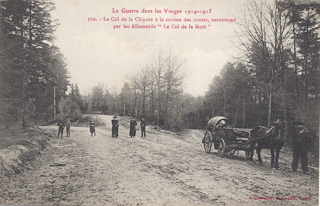
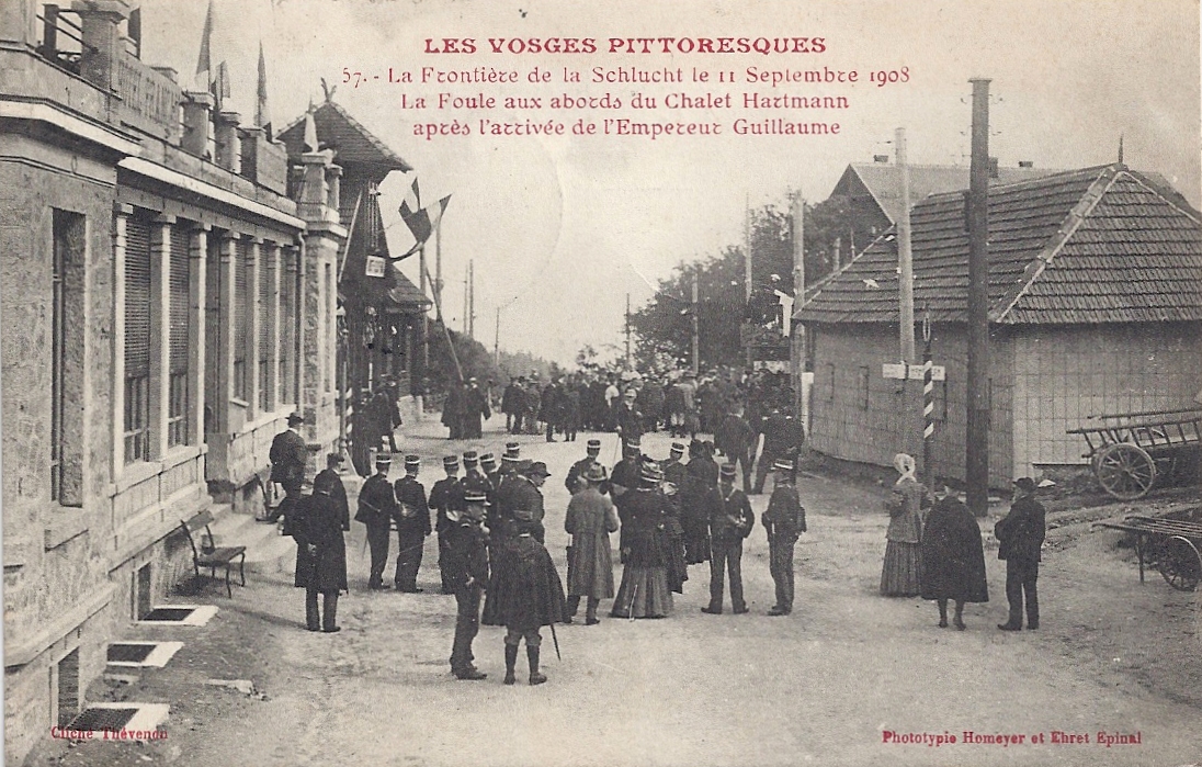
Le Col de la Chipotte (or Chipote) is in the west of the Vosges mountains on the principal route between the towns of Rambervillers and Raon-l’Étape. From Raon-l’Étape and St-Dié to its south east there are relatively easy ways through the mountains. Therefore, possession of the col was strategically vital for both the Germans and the French. Winning the Col was part of Joffre’s two-pronged strategy for reclaiming French territory lost in 1871: Alsace and Lorraine.

01 Col de la Chipote crossroads written 1916 
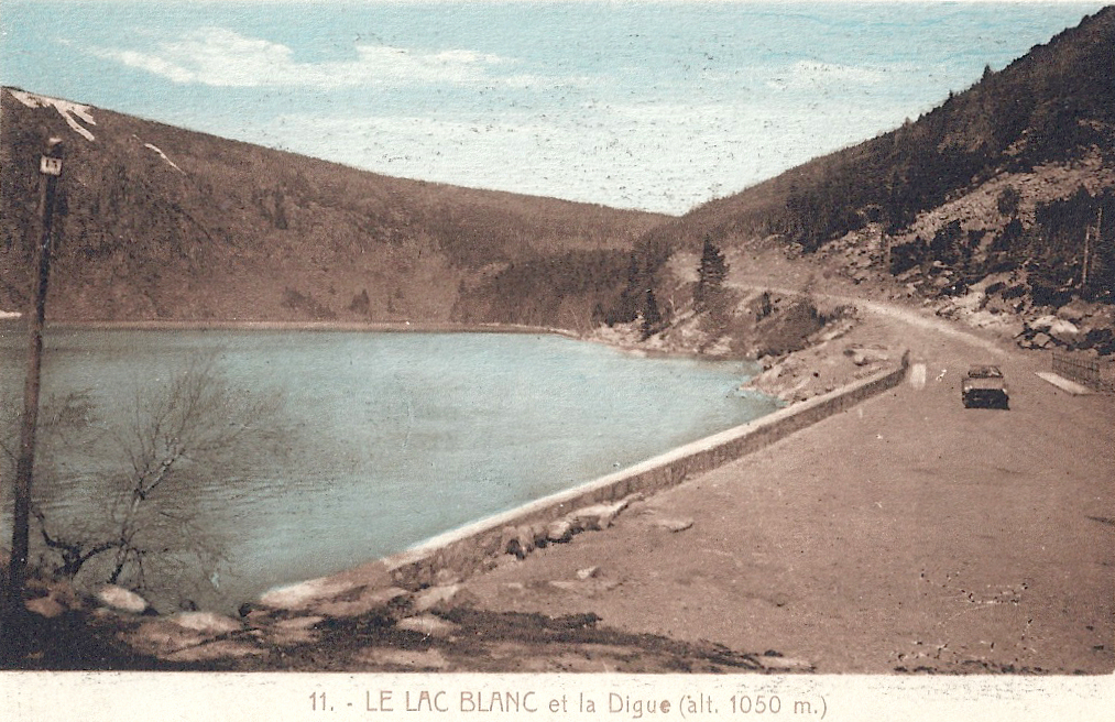
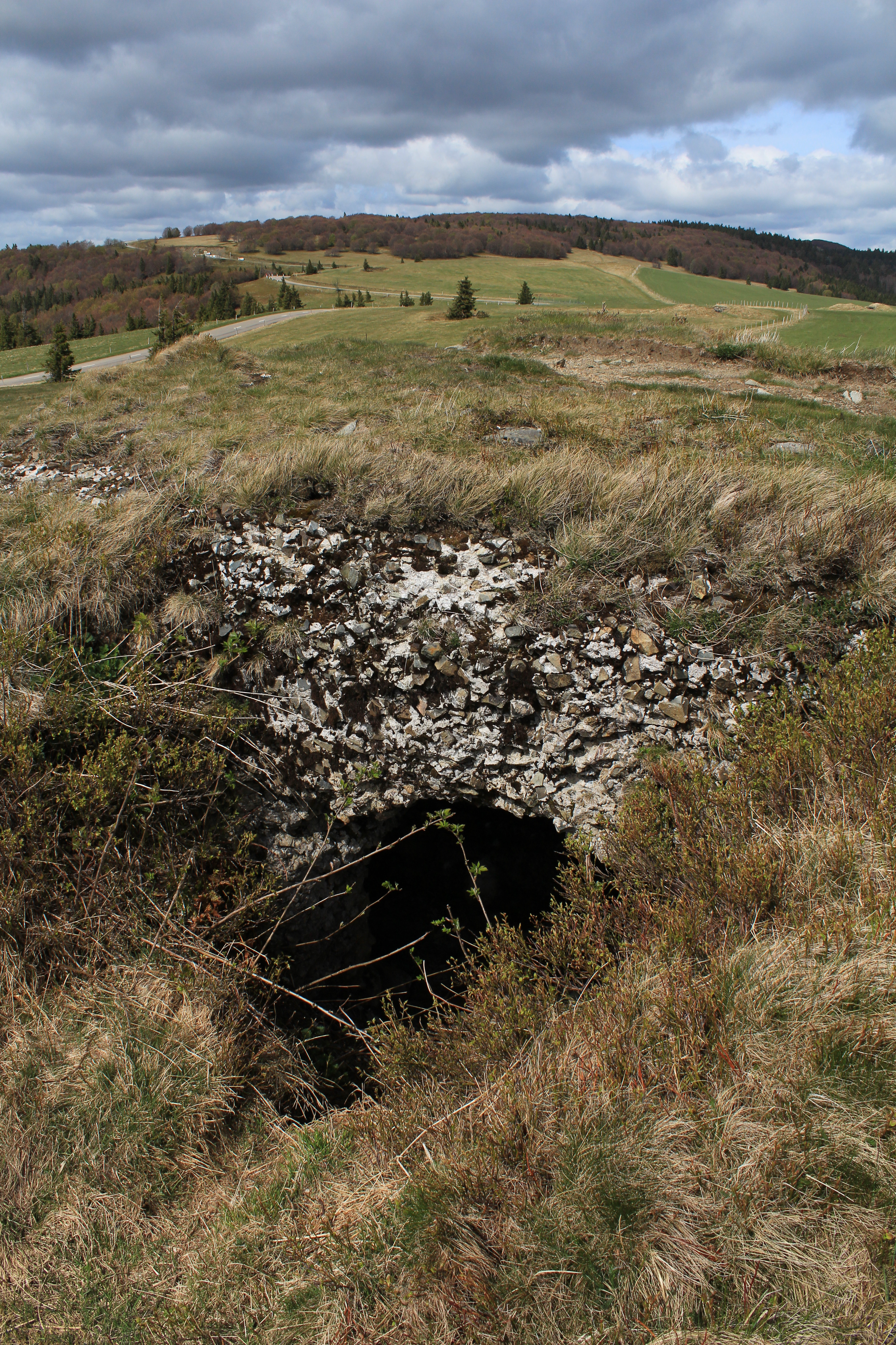
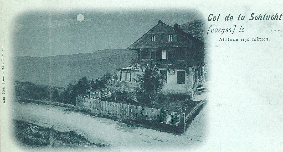
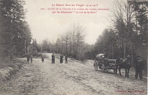
Before: a simple Vosges col at 453 metres.
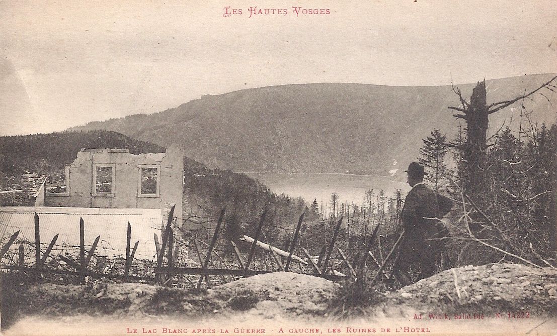
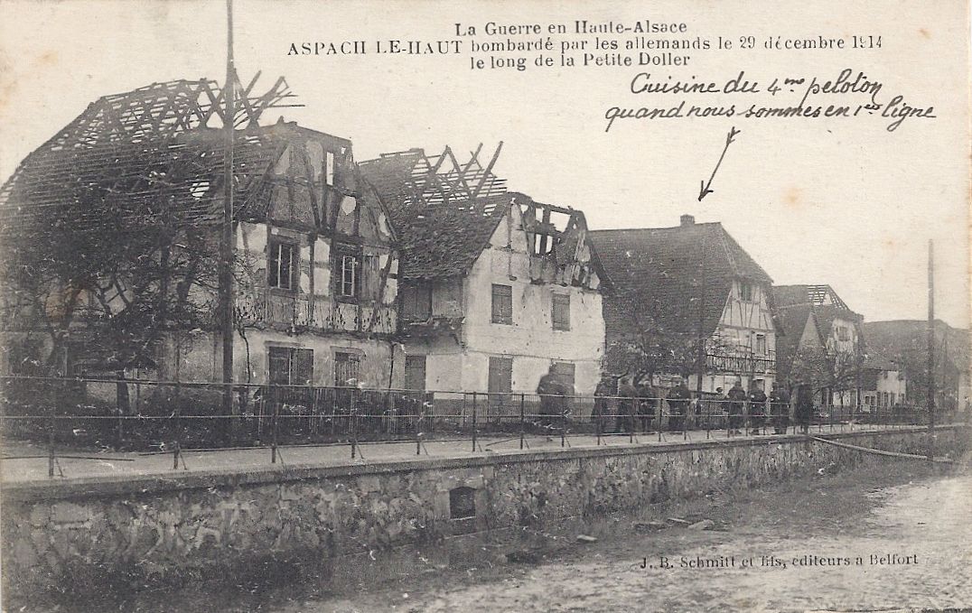
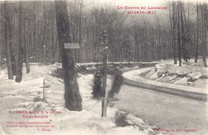
03 Col de la Chipote tombe written Feb 1919 After

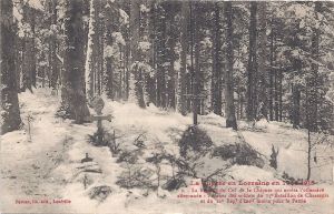
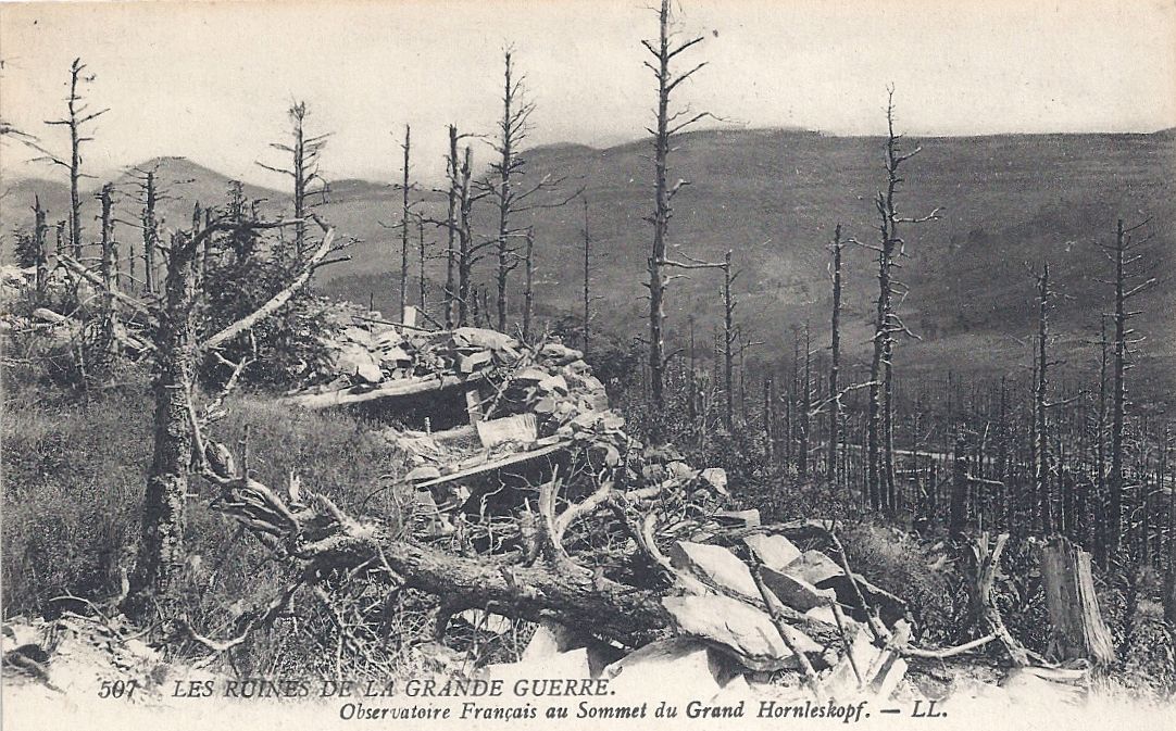
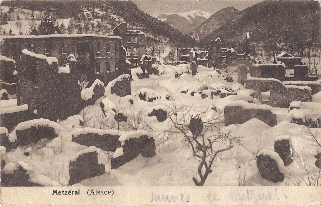
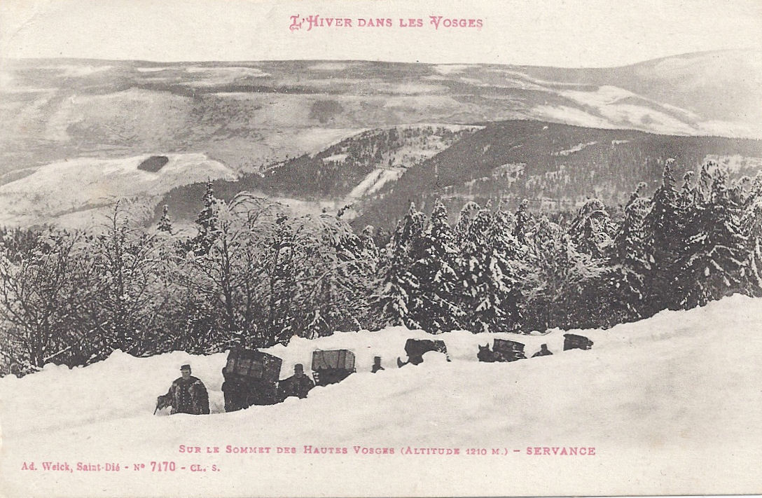
The territory is dense forest, including steep slopes and ravines. At that stage of the war, few men on either side had any experience in or training for that sort of terrain. It was almost impossible effectively to use artillery and visibility was obscured by trees. There are some small villages to the west of the col, though these were ruined by bombardment early on.

The Germans needed to be able to move their troops efficiently to other theatres of operations and by late August were in a strong position to organise their defensive strategy to progress west towards the Meurthe. On 22nd August Moltke sent the order to continue as far south as Épinal, pushing the French south and breaking their stronghold at Épinal. By the evening of the 24th August, it was considered unlikely that the French would disrupt the manoeuvres and the Germans pressed through to hold a line in the region of the villages of Étival-Moyenmoutier, Baccarat and St-Benoit in the low western foothills of the Vosges. Von Heeringen chose not to push through as far as Rambervillers and stopped at the Col de la Chipotte.

On the 25th August, the French fought back but were repelled. Some French units, separated by forests, dared not venture any further but others counter-attacked, successfully halting or even pushing back the German advance. By the evening, the Germans were ordered to suspend their forward thrust. The next day, however, they secured the forests of Sainte-Barbe. The French attacked again, somewhat overrating successes elsewhere in the region and confidently expecting their opponents to collapse.

What happened during the next day was confusing but it gives a flavour of the days to come. French unit diaries even record their soldiers hidden high in trees firing at the enemy, which may be an exaggeration. Some units failed to arrive where they were supposed to be because of failures in the transmission of orders. Others inexplicably spent the morning constructing trenches even though they had not been ordered to and the unit was not even in a status of alert. Expected reinforcements did not come. In early afternoon, the French began a retreat which quickly turned into a messy rout and by 15h00 the Germans were able to secure the col. There were already heavy casualties on both sides.

At 16h30 French troops were conscious that an attack was imminent, probably within the hour. They were heavily bombarded and hid in the woods. Panic set in and the frightened, exhausted men fled to the nearest village for shelter. Scornfully, the Germans promptly called them ‘fuyards’ [fugitives]. However, the French rallied and were able to drive the Germans back and hold the col, but at a huge cost of French lives.

On 27th, the Germans were determined to regain the Col. They needed to split the French and secure a route through the Vosges from the east to the west. The Col changed hands again and again, with a huge death toll. Despite heavy bombardments and repeated attacks over the next few days, neither side managed to secure the col.

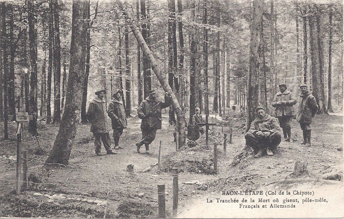
Reports claim that this small piece of land was littered with bodies, French men lying next to Germans. One unit which started on 1st August with 3000 men and 50 officers was reduced to 1050 men and 15 officers within two days of the battle for the col. Capitaine Pasdeloup, 10e BCP, wrote on 3rd September that he was commanding the remains of two companies: 190 fusiliers instead of 500. The commandant was dead, 4 captains [plus other officers] were killed or wounded, but morale was, he said, good. On 30th August, he noted that within eight minutes of an attack on Chipotte his company lost one sergeant major, one sergeant and 41 chasseurs.

Another unit diarist recorded that between 31st August and 3rd September, his unit lost 47 killed, 252 wounded and 305 had disappeared (almost certainly dead), with 5 officers killed and 9 wounded. Out of 71 officers, he said, he had 15 left: 79% had been killed or wounded. His troops had started with 4740 men and after those 4 days there were 1905 remaining, which he said represented a loss of 60%.

05 Col de la Chipote graves with kepi

In another ghastly scene, one small French unit was trapped in an isolated location surrounded by putrefying bodies for two and a half days.

In the evening of 5th September, German high command ordered its troops to cease all attacks and to prepare to move to another theatre of operations. A week later, on the 12th September, French troops reoccupied the Col de la Chipotte and fighting there ended.

Current thinking is that the soldiers on both the French and the German sides fought for the Col de la Chipotte with courage, endurance and determination. Many were inexperienced in mountain and forest combat, and the nature of the terrain undoubtedly contributed to the huge losses and injuries on both sides. One of my postcards of le Col de la Chipotte sent by a poilu from the Front instructs his wife: “Put the card in your album and save it because at la Col de la Chipotte 19000 men, French and German, fell and they are buried in the same graves.” I think his numbers may be wrong, but his sense of awe and horror is palpable.

04 Col de la Chipote mixed graves soldiers 
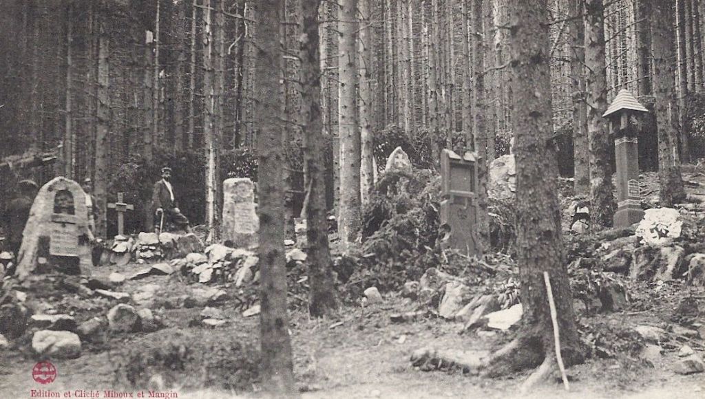
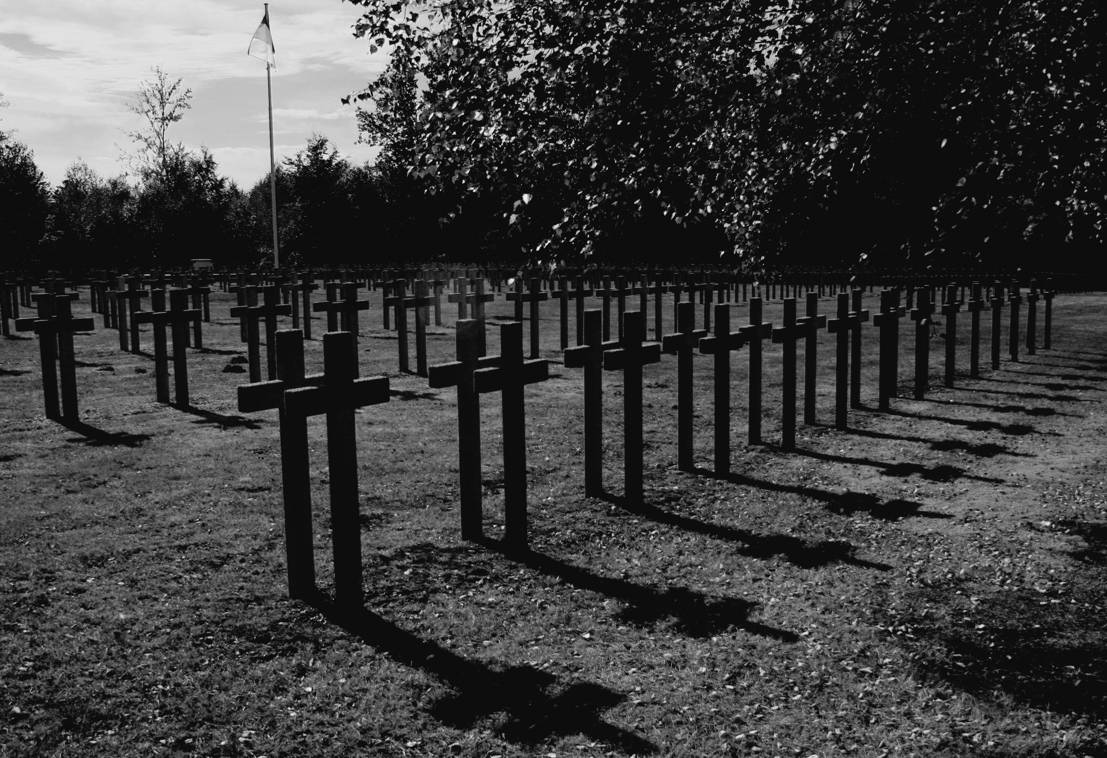
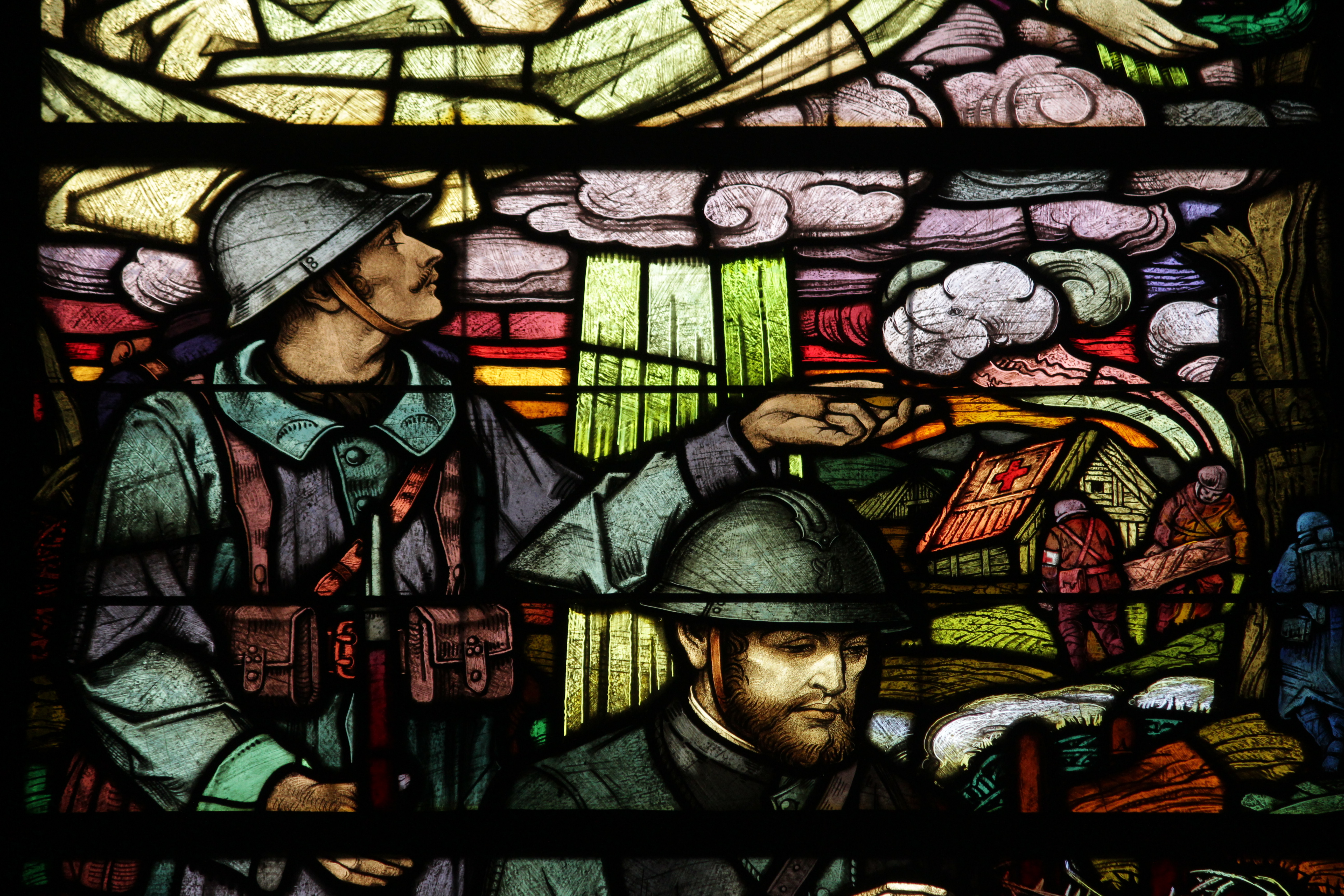
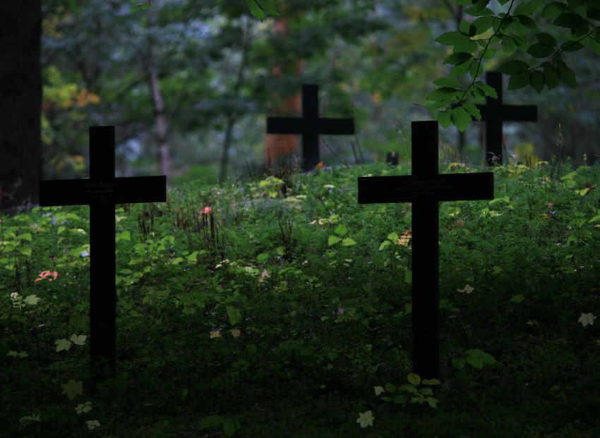
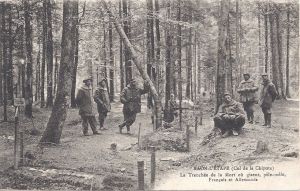
French and Germans lie dead together.

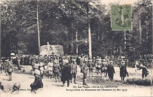
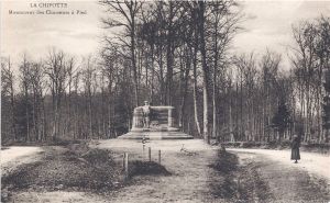
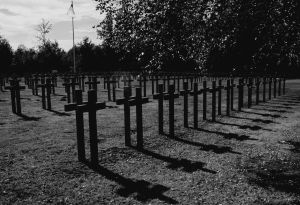
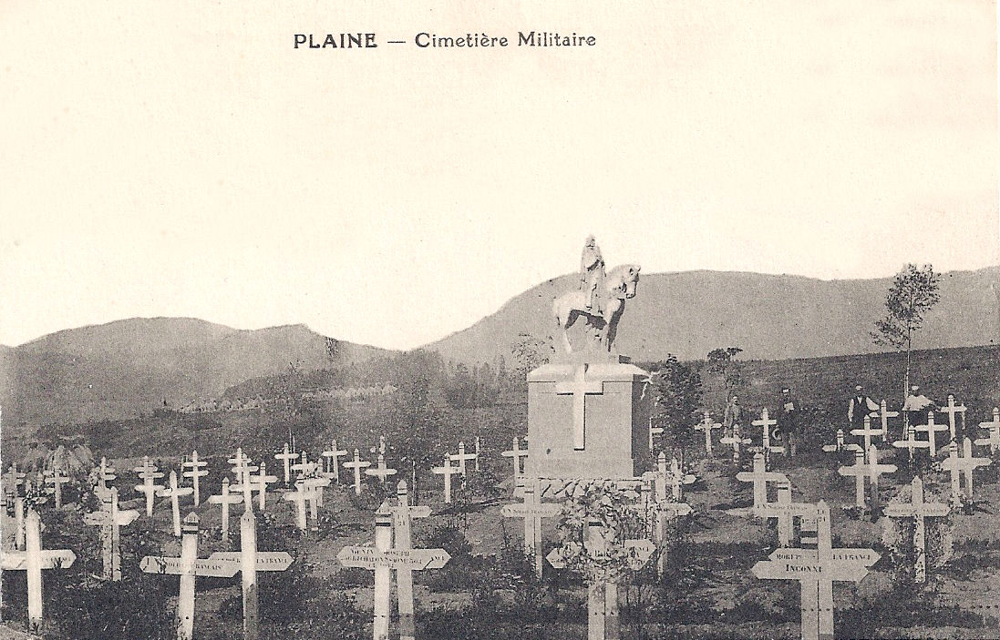
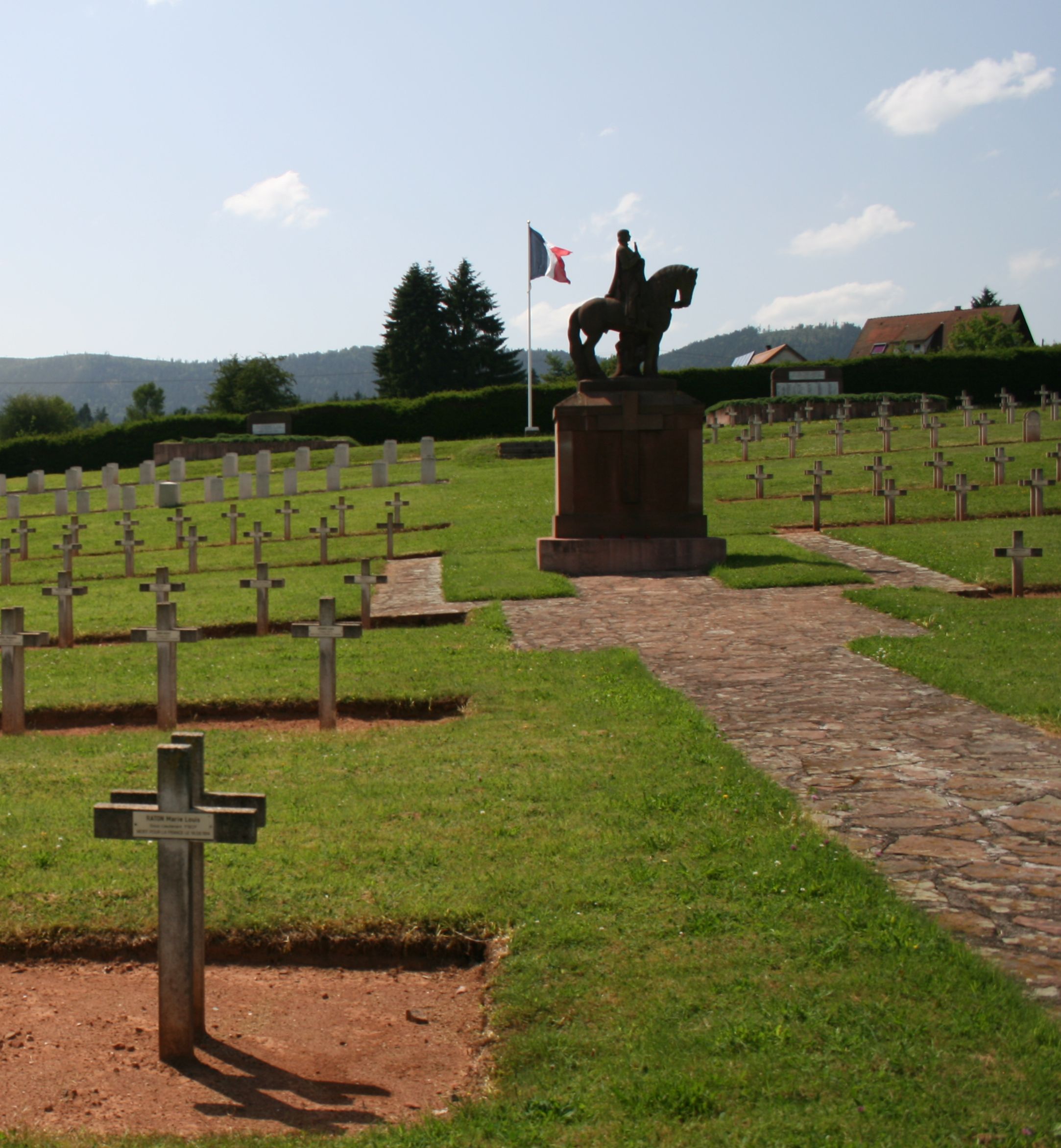
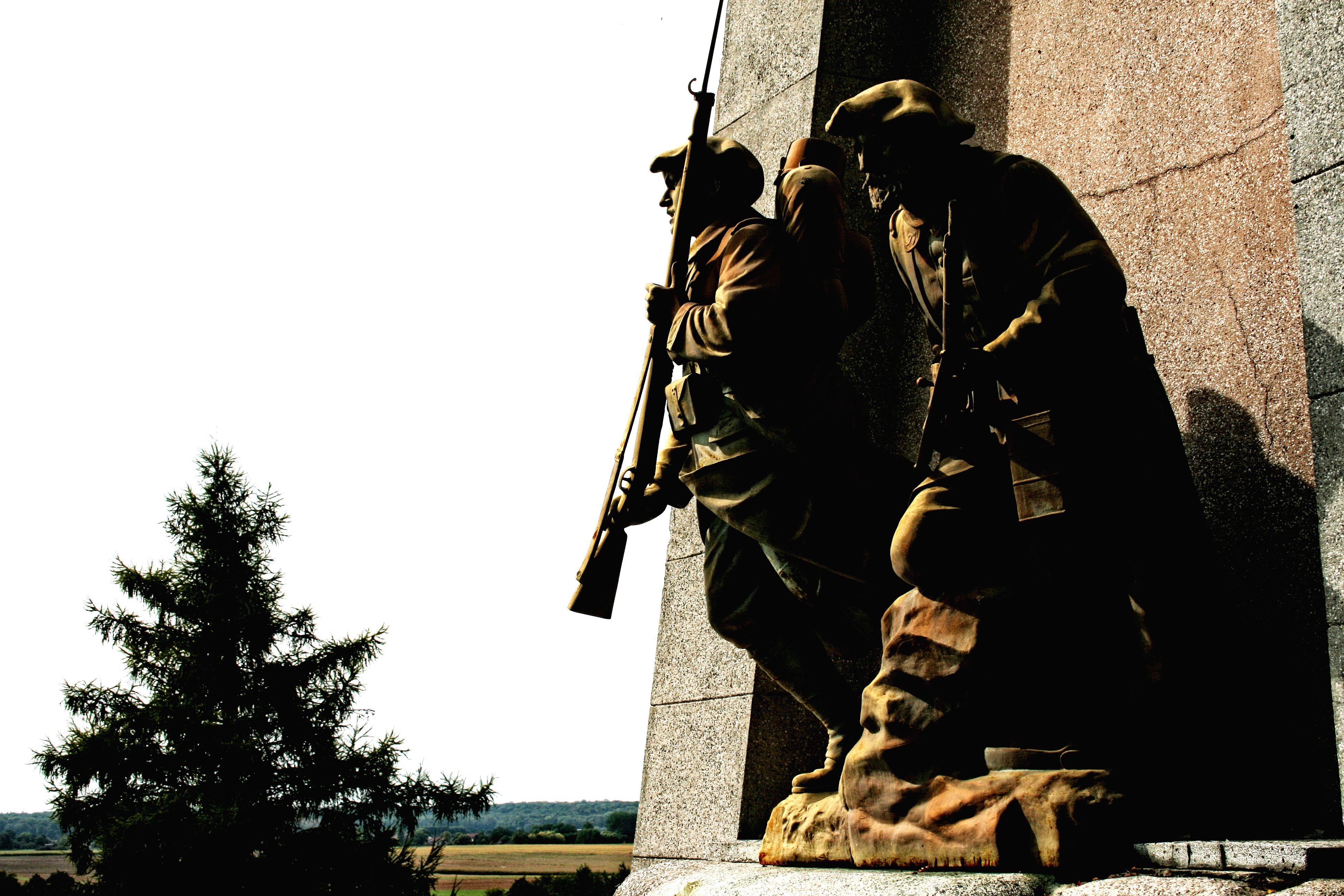
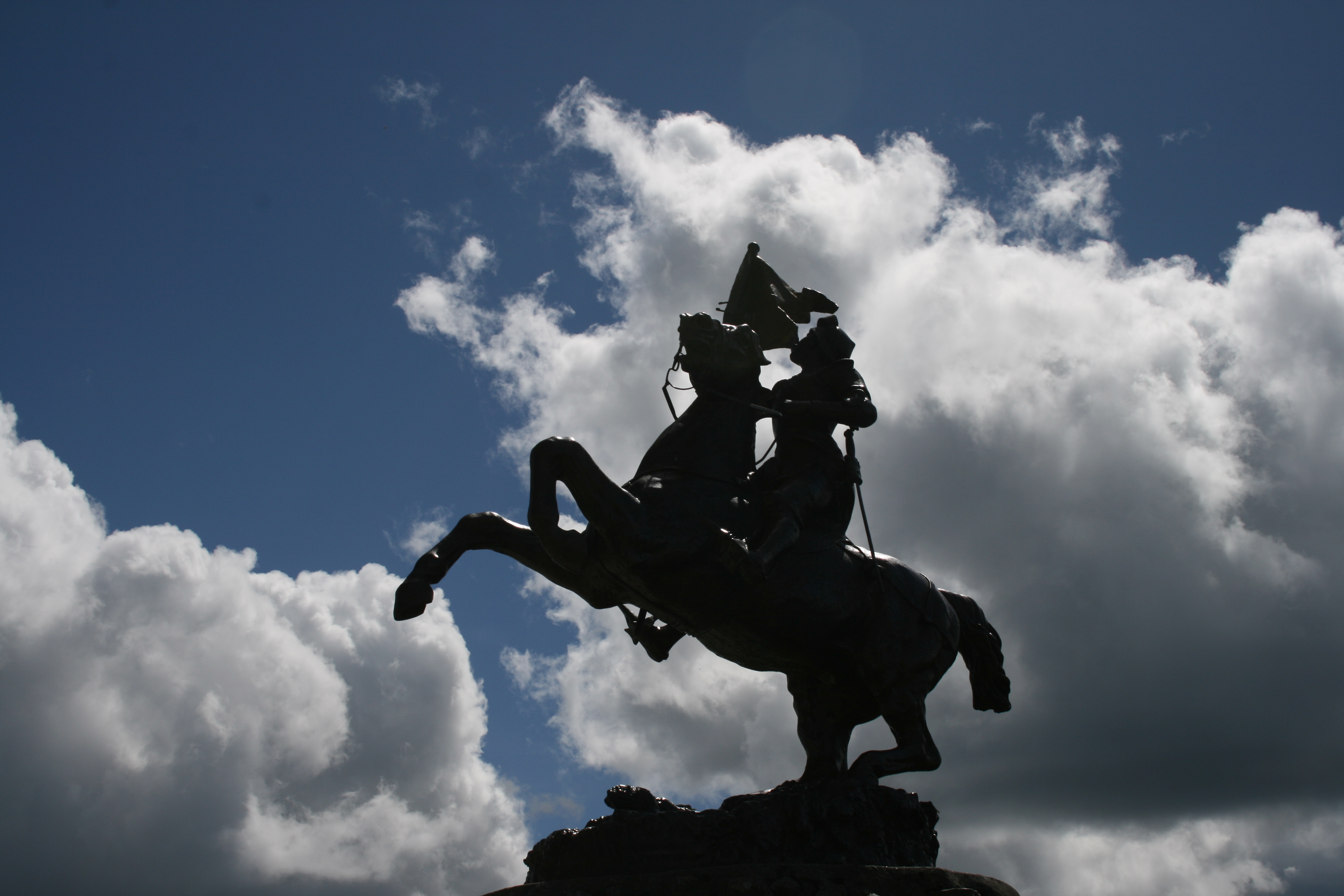
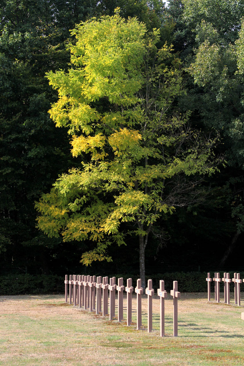
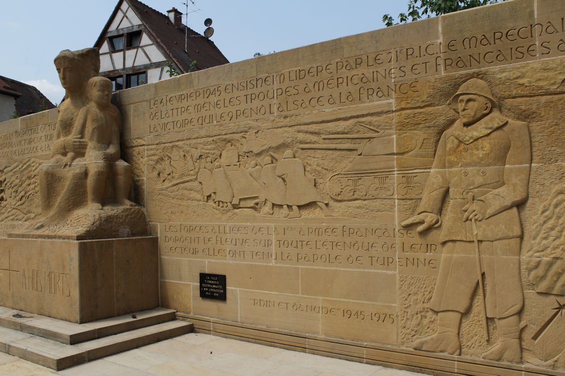
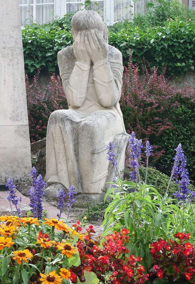
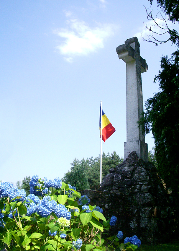
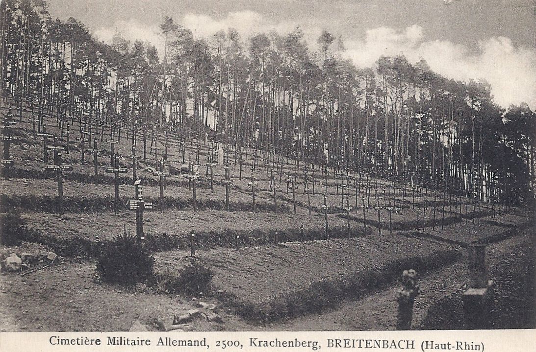
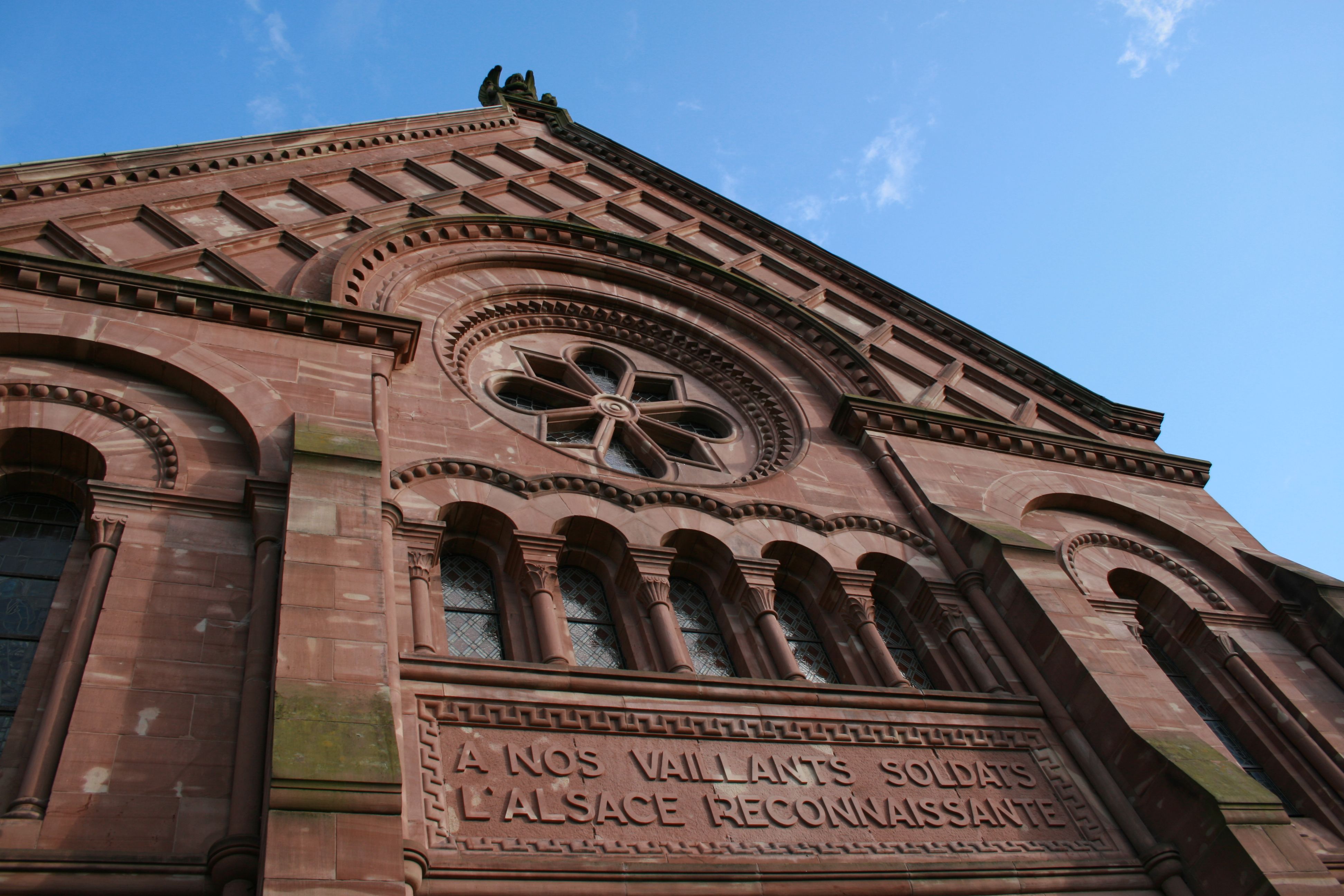
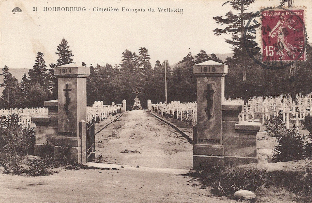
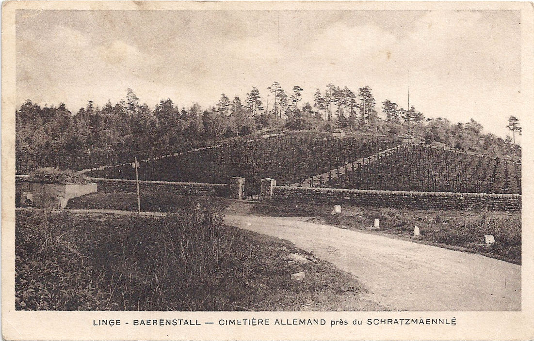
The French dead have their memorials, the Germans have none here. Cimetière Militaire de la Chipotte contains 1899 dead, plus 893 in two ossuaries. Inside the cemetery there are monuments including one to 349 unknown soldiers and a monument erected by local people (I think) to the soldiers killed on the battlefield. By the modern car parking space, there is a monument to the Chasseurs à pied and there is a roadside monument to the Colonial regiments.

02 Col de la Chipote with monument posted 1920

07 Col de la Chipotte inauguration Monument des Chasseurs

08 Col de la Chipotte Monument des Chasseurs woman bike

Col  de la Chipotte cemetery bw  September 2012

Col  de la Chipotte segment (N) September 2012

Note:

Please make allowances for the fact that I am not a military historian but an enthusiast for the Vosges and their battlefields. I intend that my text should be accessible to non-specialists. I am happy to correct mistakes.

There is a full account with maps and photographs in 14-18 magazine [Le magazine de la Grande Guerre], number 59, November-January 2013. Back issues are available from the publisher. http://www.hommell-magazines.com/magpress/site/hommell/14-18-MAGAZINE/fr/kiosk/title.html

Col de la Chipotte

All postcards and photographs my own except for the colour photo of the cemetery, which is by Nigel Holbrook.

Tour de France, Stage 10: July 14th 2014. A view through old postcards

The second day of the Tour de France in the beautiful Vosges includes some of the towns and villages which suffered terrible destruction in the Great War. It climbs to altitudes where domination was vital for observation and defence in the challenging conditions of mountain warfare.

Mulhouse

Two postcards, one showing the famous Hotel de Ville and the other the Monument aux Morts (posted 1930).

01 Mulhouse hotel de ville

02 Mulhouse monument aux morts posted 1930

Ensisheim

Behind l’hôtel de la Régence is an intriguing war memorial commemorating Ensisheim 1675 – 1975. It depicts Turenne’s victory at Turckheim in 1675, saving Alsace from the Imperial army, and the American troops who liberated Alsace and the village in 1945. There is a plaque recording the names of villagers who were deported to concentration camps.

03 Ensisheim S of Guebwiller
Ensisheim WW2

Westhalten

Like many in Alsace, Westhalten’s war memorial depicts the mourning of woman and children.

Westhalten

Soultzmatt

La Cimetière roumain, Soultzmatt, is the resting place of 678 Romanian soldiers who died in captivity during the Great War in Alsace and Lorraine.

04 Soultzmatt Roumanian cemetery

Roumanian cemetery 7

Roumanian cemetery 6

Munster

The card below, posted in 1915, shows the town of Munster before the war, looking towards Hohrod and Hohroderg. In the background are the defended observation positions of Hörnleskopf, where vestiges of German structures can still be seen, with Barrenkopf, Kleinkopf and le Linge in the further distance.

Lancaster NN766 crashed into this mountainside on January 7th, 1945. A cross on the hillside commemorates the crew.

05 Munster facing towards Hohrod posted 1915

Hörnleskopf:

5b Hörnleskopf observatoire Français au sommet

5a Hörnleskopf

A few images showing the destruction of Munster during the Great War:
06 Album - Munster la place du Couvent

07 Album - Munster rue du Dome

08 Munster rue Hohrod ruines

The civic cemetery in Munster contains the dead of two World Wars and this Bavarian lion, erected by Bavarian troops in 1916. For a fuller account, please visit my other blog:

http://mightygwyn.wordpress.com/2012/11/10/cimetiere-militaire-munster-a-place-of-stories/

09   Munster cimetière posted 1925

The Monument aux Morts in Munster before the Second World War:

10 Munster les Promenades et le Monument aux Morts

Luttenbach-près-Munster

11 Picture map Munster area WITH BOX

The camping area in Luttenbach is the site of the château of Coubertin, founder of International Olympic Committee. The château was destroyed in the Great War.

Luttenbach looks across to Reichackerkopf (c  780m), the site of extremely fierce fighting between February and April 1915. It was immensely important, partly because it controlled access to Munster and the two prongs of the valley. 4500 French soldiers and 4000 Germans were killed or lost on this small section.

There are numerous vestiges of the Great War still visible on Reichackerkopf. Many of these settlements in the two valleys were destroyed during the 14-18 war.

12 Reichackerkopf vers la Vallée de Munster

Petit Ballon (1163 m)

Kahlenwasen is now a peaceful, popular ferme auberge high on the Petit Ballon. During the Great War the farm premises were used by German troops and destroyed. Signs of trench lines are still visible. (The feature picture of this blog was taken from Kahlenwasen.) The second postcard is a military card.

13 Kahlenwasen dated 1904

14 Kahlenwasen in snow, military postcard

Sondernach

Sondernach after the Great War; and the French cemetery at Sondernach, Cimetière du Bois de Maettle:

15 Sondernach after war

16 Cimetière Sondernach

After the War, the villages close to Sondernach were left in ruins.

16a Metzeral before the War Metzeral, before the 14-18 War

16c Metzeral 17 janvier 1916 Metzeral

16b  Metzeral ruines in snow posted 1919 Metzeral

16d Metzeral pont de la Fecht postwar Metzeral

16f Mittlach multivue 1915 Mittlach (Chasseurs Alpins’ ambulance base in cellar of Mairie-école)

16e Breitenbach cimetière militaire allemand. German military cemetery, Breitenbach.

A new church was built on the site of the wrecked Chapelle d’Emm as a memorial to those who died for France in the Vosges, particularly in the bitter battle for Metzeral, June 1915. The principal memorial window is beautiful.

16g Metzeral Chapelle Emm

A nos vaillants

IMG_4479 (Detail)

Le Breitfirst

This small, naïve memorial is not far from the road through le Breitfirst (1280m). Its story is self-explanatory from the inscription.

IMG_5479

Col d’Oderen (884 m)

The Col d’Oderen was a frontier point between 1871 and 1914. The original bornes frontières can still be seen. It was also the scene of important action in December 1944. For more information and photos, please see this blog post:
https://thebluelinefrontier.wordpress.com/2014/04/10/two-quiet-cols-oderen-and-bramont/

17 Col d'Oderen posted 1906

Servance

Finally, to give a flavour of the landscape around Servance, here is a postcard showing movement of equipment on the Ballon de Servance in winter.

18 Servance sommet hiver

And these two blog posts wouldn’t be complete without …

La cigogne blanche –  symbole de l’Alsace!

Stork

All postcards and photographs are my own.

Tour de France Stage 9: July 13th, 2014. A view through old postcards

The Tour de France in the Vosges and Alsace passes some of the most historically interesting parts of the area, places significant in the period before the Great War when Alsace and Lorraine were under German occupation and sites of sadness and commemoration afterwards. Postcard writers, travellers, tourists and soldiers, sent innumerable cards home from the Vosges. This is a small selection from my own collection, following the route of the Tour in two parts, Stage 9 and Stage 10.

Gérardmer

A German shell on display in Gérardmer:

01 Col de la Schlucht Gerardmer shell on display

Travelling in style from Gérardmer to Col de la Schlucht:

02 Services automobiles Gerardmer - la Schlucht

Xonrupt-Longemer to La Roche du Diable

Le Tunnel de la Roche de Diable:

03 Col de la Schlucht tunnel with people

Le Collet

The tramway from Gérardmer up to Col de la Schlucht, close to le Collet. The tram line was used for military transport during the Great War. The embankments and the path of the tramway can still be seen.

04 Col de la Schlucht le Collet tramway posted 1908

Col de la Schlucht (1140 m) This was a busy destination on the frontier between France and Alsace (annexed to Germany, 1871). The original bornes frontières (boundary stones) can still be traced following the frontier up the hillside, marked with F on the French side and D on the German.

The German side of the frontier with a customs officer:

05 Col de la Schlucht German frontier & officer

French customs:

06 Col de la Schlucht poste de Douane française posted 1917

A military halt at Col de la Schlucht before the Great War:

07 Col de la Schlucht grand'halte militaire avant la guerre

Chasseur à Pied at Col de la Schlucht, posted 1907:

07a Chasseurs à pied posted Schlucht 1910

The Hotel Français in ruins, posted 1917. (The Hotel is the furthest building on the right hand side of the road in the first picture.)

08 Col de la Schlucht destoyed hotel written 1917

Col de la Schlucht in ruins, posted 1918:

09 Col de la Schlucht posted Nov 1918

The grand Hotel Altenberg, which hosted many international royals, politicians and celebrities before the war:

10 Col de la Schlucht Hotel Altenberg posted 1915

The Hotel Altenberg after the war (rebuilt as a hospital, now semi-derelict):

11 Col de la Schlucht Hotel Altenberg after war

Station du Lac Blanc

Lac Blanc in peaceful times:

11 Lac Blanc with car

The 1914 mountain battleground of la Tête des Faux overlooks Lac Blanc and towards the villages of Orbey and Lapoutroie. Lac Blanc after the Great War, the hotel in ruins:

12 Lac Blanc après la guerre - ruines d l'hotel

Basses-Huttes – the Tour does not visit Lac Noir, but goes close. Lac Noir was a peaceful destination with a popular restaurant. During the Great War, it was used as a place of shelter: Gen Pouydraguin had his headquarters here. The small single storey buildings to the left of the lower picture were used as a hospital. They have recently been demolished. The restaurant was rebuilt and remains busy.

12a Lac Noir snow posted 1907

12b Lac Noir Grande Guerre

Col du Wettstein (880m) The Tour enters one of its most sobering stages. 17000 men, including 10000 Chasseurs, died at le Linge between July 20th and October 15th, 1915. The French dead of le Linge, Schratzmännele and Barrenkopf lie in the great cemetery at the Col du Wettstein.

Two early postcards of the great French cemetery:

14 Wettstein

13 Wettstein cimetière Orbey

An image posted in 1930:

15 Wettstein cimetiere posted 1930

Le Linge

A selection of images showing le Linge during and after the Great War. It was, obviously, a place of pilgrimage and reflection for those who had lost loved ones or friends there, or who had experienced the hell themselves.

16 Le Linge Set 14 Barrenkopf & Schratz, road, people

17 Album - le Linge sur les pentes de la tête du Linge

18 Le Linge with tourists posted 1925

18a Le Linge Set 03  German cemetery Linge

18b Le Linge Set 10 Schratzmaennele

19 Le Linge with car and people

The German dead are buried in their military cemetery, Hohrod. The bunker outside the walls is still there, adjacent to the road.

19a Hohrod Cemetery showing bunker

19b Hohrod Barenstall German military cemetery

Trois-Épis

The town before the Great War while under German occupation, labelled with its German name Drei Ähren. There is now a  rather special German military cemetery in the town. Its headstones have been replaced with modern crosses and wild flowers dominate the grounds.

20 Drei Ahren Trois Epis

21 Trois Epis military cemetery

Trois Epis German Cemetery 2

Trois Epis German Cemetery 1

Le Markstein (1183 m) – vestiges of the Great War can easily be seen from the Route des Crêtes, established by Joffre for the efficient movement of troops and supplies.  My photo shows how close these vestiges are to the Route des Crêtes (they are best seen in spring before the vegetation has grown back).

IMG_3981

Grand Ballon (1336m)

Postcard posted 1903 written in both German (the language of Alsace in occupation) and French, which was discouraged.

22 Grand Ballon posted 1903

Uffholtz, Cernay

This is the area of Hartmannswillerkopf / le Vieil Armand, the strategically vital mountain which gave views over and control of the Rhine Valley, bitterly fought over in 1915.

23 HWK région des combats devant Cernay et HWK posted 1916

HWK autour de HWK

Next: Tour de France Stage 10 July 14th, 2014

Please explore the index of my blog for more pieces about this lovely region before the Great War!

All postcards and photographs are my own.

Chalet Hartmann: romance to ruins in 90 years

Approaching the summit of Col de la Schlucht (1139m) from the Munster valley, one of the first signs of habitation is the Hotel du Chalet. For decades travellers have refreshed themselves and relaxed here: cyclists and walkers –

Schlucht Hotel du Chalet

motorists –

Col de la Schlucht Hotel du Chalet with people & cars

and skiers –

Col de la Schlucht Hotel du Chalet with skiers

Adjoining the hotel premises is a patch of gravelly ground with a set of stone steps leading up to what looks like the foundations of a building. The excursionists of the Occupation era would have seen a pretty Swiss-style building called Chalet Hartmann here (seen in the second postcard above) and might possibly even have crossed paths with a distinguished visitor.

Col de la Schlucht 11 septembre 1908 après arrivée de l'Empereur Guillaume

1908 – crowds linger after the arrival of Wilhelm II and his entourage. The dark building on the left is the German customs building.


Chalet Hartmann was built in 1859/60 by a prominent industrialist, Frédéric Hartmann-Metzger, known for his fabric factories in Munster and his benevolent treatment of his staff, including establishing schools in the valley. He constructed the Chalet to mark the completion of the steep, winding road up to the Col from Munster begun fifteen years earlier.

Col de la Schlucht Chalet Hartmann day scene Before the Great War

Many illustrious people visited it, including Napoléon III (twice before the war of 1870) and Wilhelm II in September 1908. With Alsace returned to German territory, Hitler visited la Schlucht in 1940.

Col de la Schlucht Chalet Hartmann Kaiser visit query 28.07.1909 1908 (Unfortunately the original card is blurred.)

For part of its life, Chalet Hartmann was a restaurant popular with celebrities. It was badly damaged in the Great War, abandoned in the 1930s, and then damaged again in the Second World War. In 1946 it was completely demolished.

Col de la Schlucht Chalet Hartmann ruined A sad sight after the Great War

This is what the once beautiful Chalet Hartmann looks like now, photographed from the footpath which climbs behind the semi-derelict Hotel Tetras and overlooks the site of the original German customs building. All that remains is the set of steps into the house.

Chalet Hartmann site

The époque of a rather elegant, leisured, somewhat romantically inclined tourist industry was over and la Schlucht began to look for modern ways of exploiting the white gold of the high mountains.

Col de la Schlucht Chalet Hartmann


(All postcards and photographs are my own. Modern photographs June 2013)


An Easter card, April 1915

This card was sent from Alsace by a French soldier, Gaston, Easter 1915. I’ve translated it. The card shows Aspach-le-Haut, in the southern part of Alsace and he is spending Easter temporarily resting in Rodern (now Roderen).

Asbach le Haut military card posted April 1914

To my darling

Since yesterday evening we are again resting in the charming village of Rodern and as today is the feast of Easter we have complete rest, so I can’t let this day pass without sending a few words to you. This time I can tell you that on Friday night around ten o’clock we had an alert: it was to go and support our infantry attacking German outposts. The fight was hot: never had I seen such a storm of fire and shrapnel. Finally after one hour of fighting the enemy fled on foot and our infantry seized the front trenches. The infantry had unimaginable losses and we had none.

Now we are spending 10 days here and then we will return to the trenches. It’s like perpetually watching the same act; I ask myself, when will it all be over?

I hope that the victory will come soon and we will have the good fortune to relive the best of the old days even better than we experienced them before.

Now I have to suspend my chat with you, but I will resume soon because despite the great distance which separates our thoughts, I think of you always.

I’m still in very good health and I hope you enjoy the same. With this card I send my best memories and my sweetest kisses.

Yours forever

Gaston


Postcard my own.


The Vosges trams: Ampfersbach to la Schlucht

Ampfersbach 1

When the mist clears, and if in your imagination you replace the modern building with a distinguished Victorian hotel, you will see an alluring destination for travellers in the Vosges during the period before the Great War.

I am in the pretty valley of Ampfersbach, looking upwards –

Ampfersbach 2

and the modern sanatorium is on the site of the fabulous Hotel Altenberg with its exceptional panorama.

Col de la Schlucht Hotel Altenberg posted April 1915

At 1059 m, the luxurious Altenberg was a short walk from the frontier at Col de la Schlucht (1139m). (The original 1896 hotel was destroyed during the Great War and a new hospital building was built on the site between 1922 and 1926. It closed in 2011.) La Schlucht was a popular destination, well supplied with restaurants, hotels and cafés where the intrepid traveller could relax after a stimulating walk in the French Hautes Vosges, contemplate the lost region of Alsace and breathe in the energising mountain air. There were customs buildings for French and German officials.

Col de la Schlucht multi 1896

It is, of course, possible for energetic people to walk up to la Schlucht from Munster or Gérardmer, or to travel by horse. In 1902, the embryonic idea of running a railway up to the Col and down the other side to Gérardmer began to take shape and a tramway was built. This opened up the beautiful valley and Col to tourists from Colmar, who could travel to Munster by train and board a tram, and visitors from further afield. It was a summer service and half a million people took advantage of it between 1907 and 1913.

The tram trundled at 17 kph along the flat floor of the Munster valley, calling at little stations such as Saegmatt in the Ampfersbach valley:

Sagmatt Schlucht tram  posted 1912

It is still possible to see the slightly elevated embanked track (minus rails) along which the tram travelled. When the flat valley reached the sides of the pass, the tramway began to climb at 7.5 kph up slopes of 22% until it reached the Hotel Altenberg.

Tram Schlucht

Tram Munster-Schlucht Melkerei Altenburg posted 1907

The tramway levelled out after the Altenberg, passed under the Schlucht tunnel cut through the rocks –

Col de la Schlucht tunnel with tram

and eventually reached Col de la Schlucht. There, the customs officers awaited in their official premises at the frontier.

Col de la Schlucht German customs building & tram German customs building


Col de la Schlucht German frontier & officer German officer, French side in the background

There is much more to say about Col de la Schlucht and the trams in future posts. When the Great War broke out, the French army took the Hotel Altenberg. The tourist trams were used in the early weeks of the war for the transport of troops and the evacuation of wounded soldiers. This stopped when the German troops cut the electricity supply to the tramway.

Returning to Ampfersbach, I am fortunate to have a special card: a postcard sent by a French soldier from Ampfersbach during the Great War. He annotated it clearly, identifying:

  • the small settlement where they were based
  • a chimney next to which was the first aid post
  • the house where he slept in the cellar
  • and the German side of the front.

According to his message, the X near the church marks the place behind the cemetery wall where he was guarding the trenches. Sadly, he didn’t date or sign his card.

Ampfersbach annotated by soldier trench marked

In very faint pencil marks, he marked his trench line. I have traced his line in red.

It’s a privilege beyond words to have bought such a detailed snapshot of someone’s war for five euros.


All postcards and photographs my own.


Note:

Ampfersbach and the Hotel Altenberg are in Alsace, in the territory annexed by Germany.

Statistics about the tram sourced from La Vallée de Munster: Le Tramway Munster-Schlucht et les environs de la Schlucht by Gérard Jacquat and Gérard Leser.


Debout les Morts!

Bringing the French experience of the First World War on the Western Front to English language speakers

WW1 Revisited

A Great War Journey with Paul Reed

Lordynges, Lystenyth

Children's stories lovingly adapted into Middle English verse by Hollie L. S. Morgan

midasinreverse: ian o'brien

Poetry, thoughts, rants by @OB1Ian

In That Rich Earth...

Great War History - reviews & articles

Expériences étrangères

Expériences étrangères

WW1 Centenary

Great War Centenary 2014-2018 website by Paul Reed

halfmuffled

Looking at the members of the Surrey Association of Church Bell Ringers who served in the First World War, and closely related matters

Blindfold and Alone

The trials of British Soldiers convicted in Capital Courts Martial during the Great War

%d bloggers like this: