The Vosges trams: Ampfersbach to la Schlucht

Ampfersbach 1

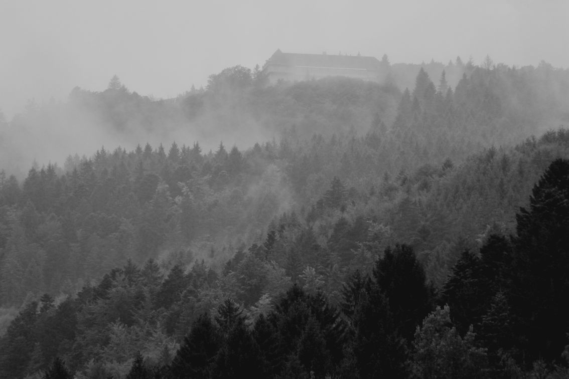
When the mist clears, and if in your imagination you replace the modern building with a distinguished Victorian hotel, you will see an alluring destination for travellers in the Vosges during the period before the Great War.

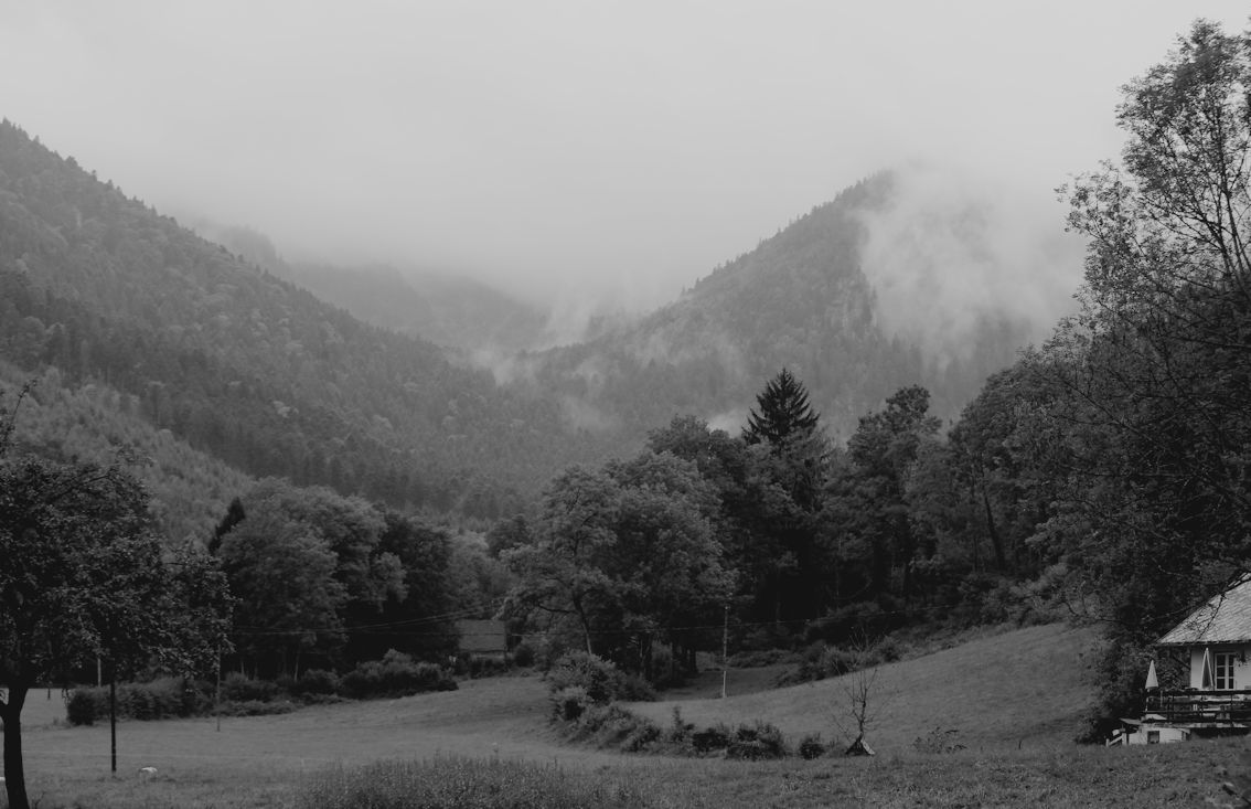
I am in the pretty valley of Ampfersbach, looking upwards –

Ampfersbach 2

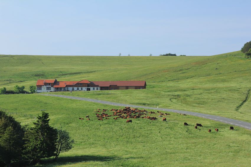
and the modern sanatorium is on the site of the fabulous Hotel Altenberg with its exceptional panorama.

Col de la Schlucht Hotel Altenberg posted April 1915

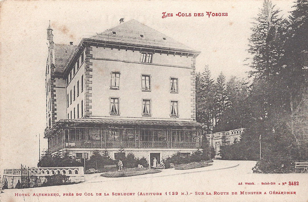
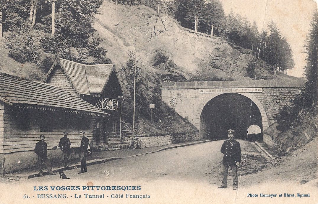
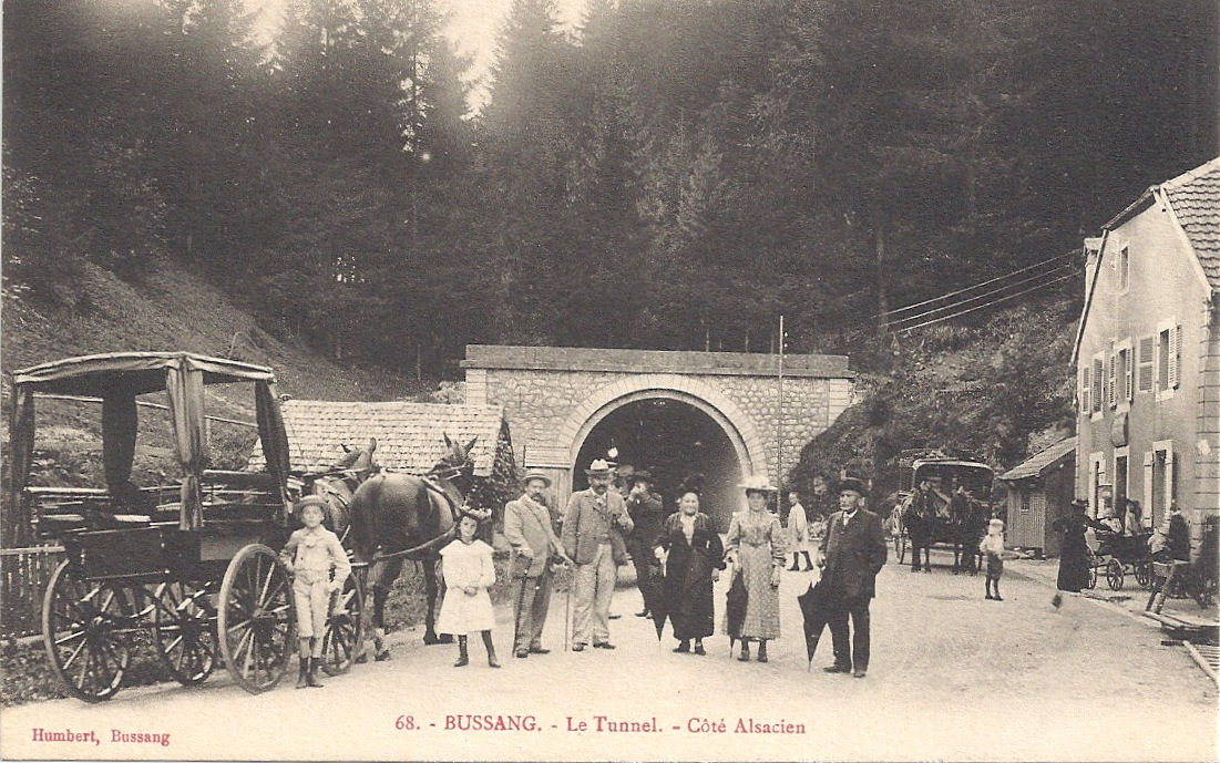
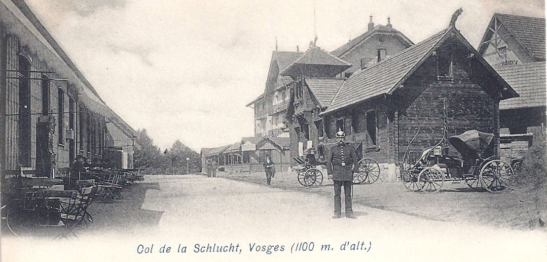
At 1059 m, the luxurious Altenberg was a short walk from the frontier at Col de la Schlucht (1139m). (The original 1896 hotel was destroyed during the Great War and a new hospital building was built on the site between 1922 and 1926. It closed in 2011.) La Schlucht was a popular destination, well supplied with restaurants, hotels and cafés where the intrepid traveller could relax after a stimulating walk in the French Hautes Vosges, contemplate the lost region of Alsace and breathe in the energising mountain air. There were customs buildings for French and German officials.

Col de la Schlucht multi 1896

It is, of course, possible for energetic people to walk up to la Schlucht from Munster or Gérardmer, or to travel by horse. In 1902, the embryonic idea of running a railway up to the Col and down the other side to Gérardmer began to take shape and a tramway was built. This opened up the beautiful valley and Col to tourists from Colmar, who could travel to Munster by train and board a tram, and visitors from further afield. It was a summer service and half a million people took advantage of it between 1907 and 1913.

The tram trundled at 17 kph along the flat floor of the Munster valley, calling at little stations such as Saegmatt in the Ampfersbach valley:

Sagmatt Schlucht tram  posted 1912

It is still possible to see the slightly elevated embanked track (minus rails) along which the tram travelled. When the flat valley reached the sides of the pass, the tramway began to climb at 7.5 kph up slopes of 22% until it reached the Hotel Altenberg.

Tram Schlucht

Tram Munster-Schlucht Melkerei Altenburg posted 1907

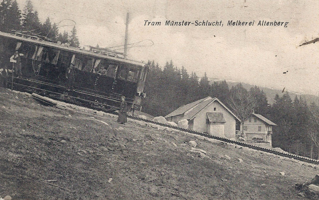
The tramway levelled out after the Altenberg, passed under the Schlucht tunnel cut through the rocks –

Col de la Schlucht tunnel with tram

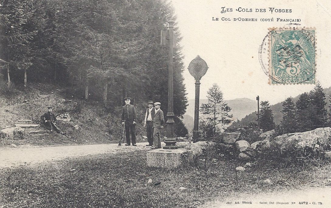
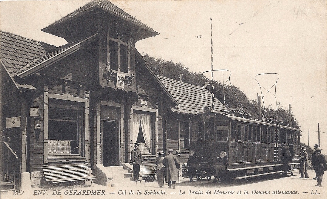
and eventually reached Col de la Schlucht. There, the customs officers awaited in their official premises at the frontier.

Col de la Schlucht German customs building & tram German customs building


Col de la Schlucht German frontier & officer German officer, French side in the background

There is much more to say about Col de la Schlucht and the trams in future posts. When the Great War broke out, the French army took the Hotel Altenberg. The tourist trams were used in the early weeks of the war for the transport of troops and the evacuation of wounded soldiers. This stopped when the German troops cut the electricity supply to the tramway.

Returning to Ampfersbach, I am fortunate to have a special card: a postcard sent by a French soldier from Ampfersbach during the Great War. He annotated it clearly, identifying:

  • the small settlement where they were based
  • a chimney next to which was the first aid post
  • the house where he slept in the cellar
  • and the German side of the front.

According to his message, the X near the church marks the place behind the cemetery wall where he was guarding the trenches. Sadly, he didn’t date or sign his card.

Ampfersbach annotated by soldier trench marked

In very faint pencil marks, he marked his trench line. I have traced his line in red.

It’s a privilege beyond words to have bought such a detailed snapshot of someone’s war for five euros.


All postcards and photographs my own.


Note:

Ampfersbach and the Hotel Altenberg are in Alsace, in the territory annexed by Germany.

Statistics about the tram sourced from La Vallée de Munster: Le Tramway Munster-Schlucht et les environs de la Schlucht by Gérard Jacquat and Gérard Leser.


Two quiet Cols: Oderen and Bramont

Compared with the bustle and activity in the better known areas of the former frontier, the Col de Bramont and the Col d’Oderen are very still. There is little traffic, mainly occasional cyclists challenging the steep routes on a blazing hot day.

The Col d’Oderen (884m) is north of the Col du Bussang on the main route between Ventron and Kruth. Unlike the busy border crossings which benefited from cafés and hotels, this remote Col does not seem to have been particular popular with tourists, though it was patrolled by customs officials watching out for contraband such as matches and tobacco.

The officers in this postcard are in annexed Alsace , on German territory, standing by the frontier posts of Germany (the round plaque with the Imperial eagle) and France (the adjacent oblong plaque nearer the photographer).

Col d'Oderen posted 1906

My photos were taken on one of those stifling summer days when the tarmac had turned to liquid black stickiness, and leaving an air-conditioned car meant stepping into a daunting blast of heat. A couple of women were peacefully picnicking under the trees. Apart from that, the air was utterly still, gently muddied by the hum of bees and ripped by the raucous cackle of magpies, with the occasional plaintive wails of birds of prey soaring in the thermals. The modern départementale stone is at the site of the ancient frontier, with borne 3102 next to it.

Oderen 2 Former French side

Oderen 1 Boundary – former frontier

Oderen borne Borne 3102

Close to the frontier is a stone monument. Its gold lettered text says:

“À la gloire des unites du groupement tactique de la 3ème D.I.A. et de son chef le Général Duval qui libérerent Ventron le 25 novembre 1944 et s’emparerent du Col d’Oderen le 1er décembre 1944 après de rudes combats.”

[la 3ème D.I.A. = 33e division d’infanterie algérienne]

This is a Second World War action. Briefly* : Alsace was again occupied by Germany. 3ème DIA pushed the enemy back from the Gérardmer area through the Vosges cols of Bussang, Oderen and Bramont, liberating various small towns and eventually reaching Colmar, thus playing an important role in facilitating the liberation of Alsace in 1945. It’s worth remembering that Vosges winters are bitter. The icy cold in 1944/5 was unbearably raw.

Col d'Oderen monument original


The Col de Bramont (956m) is north of the Col d’Oderen, east of the busy ski resort la Bresse and south of the popular Col de la Schlucht. It is one of the wilder of the frontier cols, and in the period when it was actively guarded, there was nothing at all there apart from a small wooden hut which provided shelter for customs officials. Consequently smuggling flourished in the area. Contemporary postcards reveal a muddy, poorly-formed road, surrounded by ferns and forest. It looks inaccessible and still is fairly difficult in places : the D-road from Wildenstein climbs a series of steep, challenging hairpin bends.

My photograph was taken looking into the former German territory from the former French side and the contemporary postcard shows the same view from the opposite side of the road. The German frontier post (with the eagle) is approximately where the départementale sign is now. The photographer was probably standing by the douaniers’ hut.


Col du Bramont looking to German side

Col de Bramont posted 1902 edited


A pleasant drive or walk from the Col de Bramont is to follow the signs to Col de la Vierge and Lac des Corbeaux (via chemin Béry). The pretty lake is in a perfectly formed glacial corrie surrounded by pine forests. It’s popular for gentle pottering round the lake, strolls along shaded woodland paths, fishing and just relaxing with a picnic. Apparently the water is very cold even in summer – though swimming from the sandy beaches is officially forbidden. However, I suspect that on a future visit, the bathing costumes may well be ready in the car!

Lac des Corbeaux


All postcards and photographs my own.


*Note: further reading in English on Alsace and the Vosges in the Second World War includes:

Bonn, Keith. When the odds were even: The Vosges Mountain Campaign October 1944 – January 1945

Whiting, Charles. The Other Battle of the Bulge: Operation Northwind

Zaloga, Steven J. Operation Nordwind 1945. Hitler’s last offensive in the West


The start of a 550 km journey: the Col du Bussang and the Moselle

On the former French side of the Col du Bussang a small stream emerges from an insignificant hole in the hillside. It is distinguished only by the shape sculpted around it: an M shape which could represent mountains…

Moselle M

… or indicate the name of the river. An elegant design set into the adjacent wall informs you that this is the source of the Moselle at 715 m and a map traces the route through France and Germany (where it becomes the Mosel) to Koblenz, where it flows grandly into the Rhine, 550 km from its insignificant source.

Moselle map

Now the main road N66 races through the Col, taking heavy traffic through the Vosges between Thann and Remiremont on dual carriageways and viaducts. About a kilometre onwards from the Col, a traveller in the time of Reichsland Elsaß-Lothringen would be able to see the bridge over le Séchenat, a tributary of the Moselle. In these two postcards, horse-drawn traffic is warily crossing the Pont du Séchenat.

Bussang Pont de Sechenat Grand Hôtel des Sources

Bussang Pont de Sechenat winter

In three kilometres or so the road down from the Col flattens out into the valley of Bussang, distantly overlooked by the Ballon d’Alsace* to the south. It then heads on west, under the shadow of the Ballon de Servance.

Bussang Vue générale et le Ballon-d'Alsace

Looking at the bitter winter climate even lower down from the heights, it’s unsurprising that the military personnel stationed on the Ballon du Servance needed protective clothing.

Ballon de Servance La Tenue de la Troupe en hiver au Ballon de Servance


All photographs and postcards are my own.

*Please see other blog posts to read more about the Ballon d’Alsace.

Crossing the frontier by tunnel: the Col de Bussang

See d'Urbes resized

The main road between Thann and Remiremont passes the tranquil, natural lake of the See d’Urbès, where you can walk round the water’s edge and watch dragonflies darting among the marshes. You can take the little road to peaceful Storckensohn, walk past the pretty Alsacien houses and pause by the old oil mill, a watermill. I imagine that visitors from a century ago would have seen a similar scene.

Afternoon sun Urbes  –  Storckensohn. Timeless –  The oil mill, Urbes

Then you can return to the main N66 and begin the winding climb to the Col de Bussang. You pass the memorial to those whose lives ended in the Dachau satellite camp at the foot of Vallon. (It was also administratively connected to the concentration camp at Natzweiler-Struthof, 50 km SE of Strasbourg.) In 1944, the Germans requisitioned a partly complete early rail tunnel to the west of Urbès for an arms factory under the Daimler-Benz umbrella, in a scheme which was code-named KRANISCH-10. Two thousand prisoners and deportees, arriving in waves, were employed in atrocious conditions there between March and September 1944. A current project (2012-2016) aims to provide a memorial to those who worked and died there, with interpretation panels, a trail, a rose bed and art works by young people.*

Memorial

The N66 is a fast, winding road and I imagine that many drivers keen to finish the steep climb to the Col du Bussang (731m) are completely unaware that just to the north of the summit (the col) there is a tunnel through the hillside. It replaced an important road which passed above the site where the tunnel was constructed. The sign over the French entrance to the tunnel was specific: Limite de territoire français 155m de l’origine de tunnel. Shortly after entering the tunnel, the traveller was entering German territory.

Col de Bussang Côté Français

Customs and security on the other side of the tunnel were markedly different from that on the French side, in the officials’ uniforms and the language.

Col de Bussang côté de l'Alsace  Wirtschaft zum Tunnel

The tunnel was a great draw for tourists and travellers. The café was, I believe, Café Murat and postcards dated after the Great War show that ‘Wirtschaft zum Tunnel’ was promptly obliterated and replaced with ‘Café du tunnel’.

Col de Bussang Alsace side

Col de Bussang after war   Café du Tunnel

The entrance to the tunnel is still visible from the former German side (the Urbès side), but I have not been able to see any evidence of the former French entrance (the Bussang side). However, you can see the source of the great river Moselle (Mosel) as it trickles out of the hillside. (Take the D89, route des Sources, not avenue des Sources, and after passing the turning up the hill to Drumont there is a small picnic area at the source.)

Tunnel Col Urbes side (Former German side. Tunnel to the left of the picture. Modern hotel.)

These two cards demonstrate the difficulties of travelling through the Vosges in winter. Both show the French side of the frontier and the customs officials are visible in each. (The stamped card was posted in Wesserling, Alsace, German territory at that time, hence the German stamp.) The small chalet nearest the camera was built by Touring-Club.

Col de Bussang sous la Neige - La frontière en sortant du Tunnel

Col de Bussang route de Wesserling

The N66 remains an important road under pressure. In earlier centuries the route was vital for the defence of France and the movement of troops through the Vosges towards the Swiss border; now trucks are its significant load. The fast road is worth using briefly for the natural beauty on either side of the Col: from St-Maurice you can pick up the steep route to the Ballon d’Alsace , or it’s pleasant to linger in the tranquil nature reserves and lakes near Urbès and Kruth.

Window box

All postcards and photographs are my own.

• For more information please see http://www.struthof.fr/fr/nos-partenaires/memoriaux-des-camps-annexes/ and click on le Kommando Urbès. Also see http://www.lieux-insolites.fr/alsace/urbes/urbes.htm

Fresh air and fun: Winter tourism on the Ballon d’Alsace before the Great War

Ballon d'Alsace Jumenterie in snow Hôtel de la Jumenterie (left) and farm

People living in developing industrial areas, in expanding cities such as Strasbourg and in increasingly urban environments viewed the mountains tracing their blue line on the horizon and dreamed of escapes to rural idylls where they could recapture an historic rural lifestyle, breathe fresh air and benefit from outdoor exercise. By the early twentieth century, the mountain areas were increasingly accessible and for those in north eastern France or in the territories to the east of the frontier, the Vosges offered beautiful landscapes, snow, space, pure air, a healthy environment and a range of accommodation. Families could choose between hotels, chalets and small establishments whether they were simply intending to explore the Massif privately or participate in great public  events.

Organisations dedicated to the pleasures and practicalities of visiting the mountains developed and by the time the Great War was on the horizon, these clubs were flourishing. Ski-club Vogesen-Straßburg was launched in 1896 – the German name was used  because Strasbourg was in Reichsland Elsaß-Lothringen, the annexed part of France – and in 1902, the defiantly named Les Vosges-Trotters de Colmar was started by French-minded Alsaciens. Some of these clubs were modelled on the winter sports clubs which were already popular in the Black Forest, on the other side of the Rhine.

Ballon d'Alsace skiers, piste, Feb 1910 Skiers, Ballon d’Alsace, February 1910

The idea of a rural idyll was partly a myth, but it was a myth enthusiastically fostered by travel organisations and tourist literature. La Compagnie des Chemins de fer de l’Est promoted the Vosges with a vigorous poster campaign. Numerous intrepid travellers published works describing the unspoiled romantic beauty of the Vosges, an area apparently populated by simple honest folk who sang as they went about their daily lives and mingled with innocent animals straight out of fairy tales. The shallow, charming portraits almost entirely ignored the fact that the Vosges is a working area.

Ballon d'Alsace Jumenterie corridor to farm in snow Path cut to provide access to the farm

Ballon d'Alsace la récolte de la glace Cutting a path through the snow

However, the tourists came. Refuges were built, some by Club Vosgien*, chalets were constructed, farmers saw the opportunity to sell refreshments and their own produce such as cheese.

Visitors tended to gravitate towards their nearest mountain heights. The Ballon d’Alsace drew many visitors from the Belfort region to the south of the Vosges. Several hoteliers set up premises at the summit and one particularly original one is the ‘new’ Hôtel de la Jumenterie. It was built on the site of a small farm and its crenelated appearance deliberately evokes an historic past. The original jumenterie was a stable for brood mares, established by the Ducs de Lorraine in the 18th century. There is still la Jumenterie, now a riding-based holiday centre on the road to St-Maurice, but it does not use the original premises. I’ve been unable to see evidence of these and I think they have been demolished.

Ballon d'Alsace Jumenterie engloutie sous la neige Road snowed up between Hôtel de la Jumenterie (left) and farm

Yet, despite the tourists, the Ballon d’Alsace was still a frontier area, and customs officials still had to pursue their responsibilities, even in the bitterest winter, the deepest snows. The fun was a temporary mask; the realities could be extremely harsh, as the soldiers serving in the Hautes-Vosges in the Great War would discover in little more than a decade’s time.

Ballon d'Alsace Vierge dans un bloc de glace The statue of la Vierge du Sommet, Notre-Dame du Ballon, completely frozen into an ice sculpture

Ballon d'Alsace la Baraque des Douanes en hiver written 1911 The customs officers’ premises, card posted 1911

*Club Vosgien, founded 1872, focussed on walkers. It mapped footpaths and provided excellent sign posts through the whole massif of the Vosges. Today they have covered 17000 km of paths. Appealing to the less bourgeois who might not be attracted to the winter sports culture, Les Amis de la nature came to the Vosges just before the Great War, founding branches from 1912-14.  

All postcards my own


The frontier in the south: the Ballon d’Alsace

 Ballon d'Alsace cafes   View across Rhine plain to Black Forest.

In fine weather, people today head off up to the Ballon d’Alsace. In hot weather, it’s refreshing and there are cafés and souvenir shops to tempt exhausted travellers.  You can walk round the summit , watch the parapentists, admire the orchids, contemplate the  dramatic monument aux Démineurs (1952) and even spot remnants of the trenches from Great War.

The scene on the mountain summit (1247m) has not changed much since the period of the frontier when it was a popular attraction for walkers and later, cyclists and motorists. Several establishments were set up to benefit from increasing tourism; there were hotels and cafes to refresh travellers exhausted from the demanding walk, winding drive or steep cycle ride to the summit. The views are spectacular, including the Vosgien massif, the Rhine plain and the Black Forest. At certain times of year, when the vegetation had died down, it was sometimes possible for the traveller to see chasseurs à pied (infantry) on manoeuvres or even local patriotic groups practising military tactics.

Ballon d'Alsace overview

Ballon d'Alsace Le Sommet et la Borne Frontiere 1914  Card posted 1914; borne frontière.

Ballon d'Alsace Summit car people borne

This part of the frontier was particularly susceptible to smuggling: illegal trade in tobacco was especially rife. Consequently the customs officials were firmly established in an attempt to intercept the smugglers. A new customs building on the descent to Giromagny was built before the Great War. (Not shown)

Ballon d'Alsace Borne Zéro posted Feb 1910  Card posted 1910.

Ballon d'Alsace La Borne people and dog

The current borne routière interdepartemental is close to the Bar des Démineurs and the 1952 monument aux Démineurs, but in the fields by the terrasse of the Ferme auberge du Ballon is the original borne signifying the frontier.  It is small, square, sturdy and the F for France is clear.

Ballon d'Alsace borne

The author Charles-Marie Laurent recorded his observations: he noted the damage to many hated stones, where the face looking towards Germany had been hacked at, chipped, shot, deeply cut and dented. “Infortunés et braves Alsaciens!” he declared.

Ballon d'Alsace statue de Jeanne d'arc

Looking across the Rhine plain to the Black Forest is Jeanne d’Arc. She is proud, defiant, deliberately positioned to show that Alsace and Lorraine challenge their annexation and to provide hope of return to those who chose to resettle on the French side of the new border. Mathurin Marchal was the sculptor and apparently more than ten thousand patriotic Alsaciens attended its inauguration in 1909, eager to see the proud symbol of their desire that the lost regions be returned to France. Jeanne has actually changed position more than once: at one stage she faced France to call the motherland to rescue the abandoned people.

Jeanne Ballon

Another popular attraction was the statue of Mary: la Vierge du Sommet, Notre-Dame du Ballon. Although she is close to the frontier, she was actually erected in 1862 by a farmer, Joseph Grisward, in gratitude for being saved from a severe snowstorm in 1860. Later on, though, after the Treaty of Frankfurt, the phrase ‘Marie protégez la France’ was added, which C-M Laurent thought had an air of being wise after the event.

Despite its loathed frontier and all it represented, the Ballon was a place for play and excitement. Motorists enjoyed the challenge of the steep, winding road to the summit and the opportunity to speed on the top.  In 1905-6 the mountain featured in the Tour de France Automobile and it was also included in the 1905 Tour de France.

Ballon d'Alsace La Borne et le Sommet (cars)

Ballon d'Alsace La montée devant le Poste des Douaniers posted 1907

Spring on the Ballon d’Alsace is pleasant, often with the traces of snow remaining in the crevices, evidence of the bitter winters. Then, life on the frontier became far more challenging. In a future post, I’ll write about the experience of winter on the Ballon d’Alsace.

Ballon d'Alsace ferme

Photographs June 2012 and June 2013.

All postcards from my collection.

Debout les Morts!

Bringing the French experience of the First World War on the Western Front to English language speakers

WW1 Revisited

A Great War Journey with Paul Reed

Lordynges, Lystenyth

Children's stories lovingly adapted into Middle English verse by Hollie L. S. Morgan

midasinreverse: ian o'brien

Poetry, thoughts, rants by @OB1Ian

In That Rich Earth...

Great War History - reviews & articles

Expériences étrangères

Expériences étrangères

WW1 Centenary

Great War Centenary 2014-2018 website by Paul Reed

halfmuffled

Looking at the members of the Surrey Association of Church Bell Ringers who served in the First World War, and closely related matters

Blindfold and Alone

The trials of British Soldiers convicted in Capital Courts Martial during the Great War

%d bloggers like this: