April 1915: “Poisson d’Avril” & “Heureuses Pâques”

Poisson d’Avril

Even in war conditions, in an atmosphere which was far from funny, the French soldier might recall the absurd, fun tradition of poisson d’Avril (where a child sticks a paper fish on a victim’s back as an April Fool’s Day trick) by sending a postcard. This one has a particularly patriotic theme: Alsace personified is tied to a tree somewhere in recognisably Alsacien mountain terrain. However, an heroic French soldier is appearing riding a fish to her rescue. The fish’s colours of red and white, combined with his blue, signify patriotism. A German soldier is just seen skulking away. The image is ludicrous but the message is hopeful and serious: “Dearest Alsace! Liberty at last!”

This card from my collection was posted on 1st April 1915.

Patriotic Poisson d'Avril posted 1.4.1915


Easter

As far as possible, French soldiers marked Easter, though tinged with sadness; many fathers took the opportunity to send postcards or letters to their children to show that they were thinking of them, and cards were sent to and by their loved ones. Sometimes Christian services were possible, with music, hymns and communion.

Many cards have a patriotic, propaganda flavour. In this one, the tradition of Easter eggs is surreally taken further and to the soldiers’ delight, the egg cracks open to reveal Alsace (with the black coiffe) and Lorraine (in the lace cap). They are clutching the French flag and Alsace’s dress is tinged with the French colours red, white and blue. The message in the bottom left hand corner is Revanche: revenge, the return of the lost territory, and the cheering soldiers reflect the anticipated joy when the two regions will be restored to France.

This card was sent in April 1915 by two friends to Bruno who was serving at sea. As far as I can find out, he survived the war.


Patriotic Hereuses Pâques sent 1915

Two quiet Cols: Oderen and Bramont

Compared with the bustle and activity in the better known areas of the former frontier, the Col de Bramont and the Col d’Oderen are very still. There is little traffic, mainly occasional cyclists challenging the steep routes on a blazing hot day.

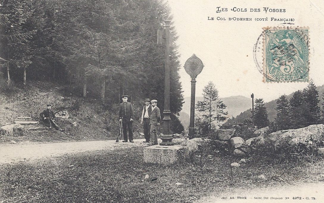
The Col d’Oderen (884m) is north of the Col du Bussang on the main route between Ventron and Kruth. Unlike the busy border crossings which benefited from cafés and hotels, this remote Col does not seem to have been particular popular with tourists, though it was patrolled by customs officials watching out for contraband such as matches and tobacco.

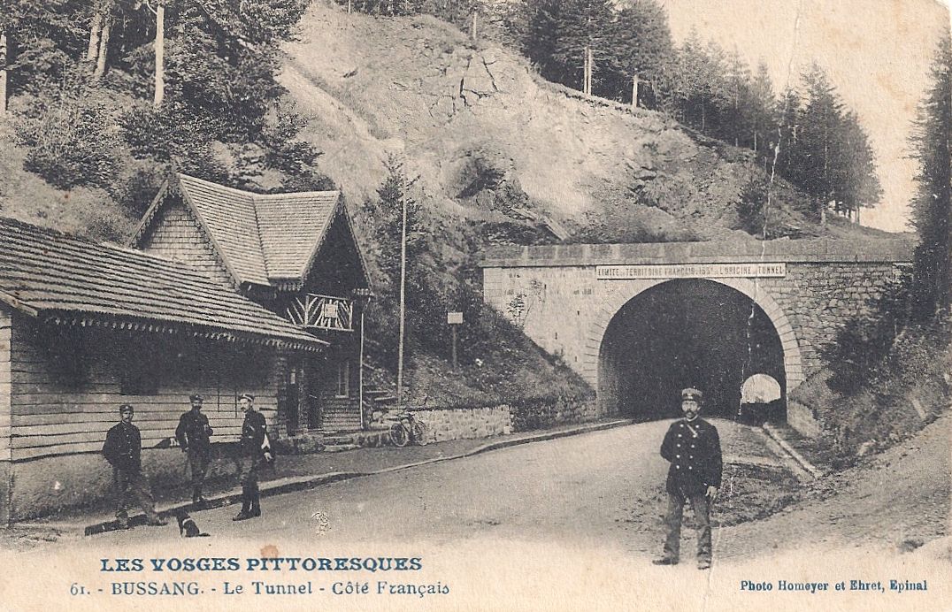
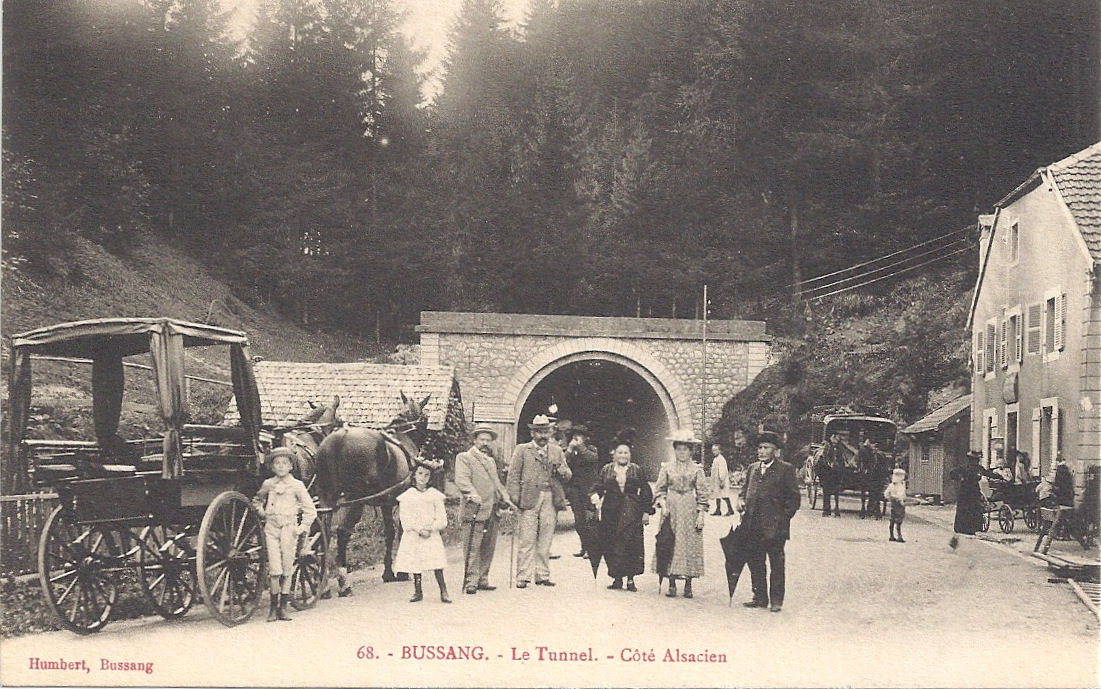
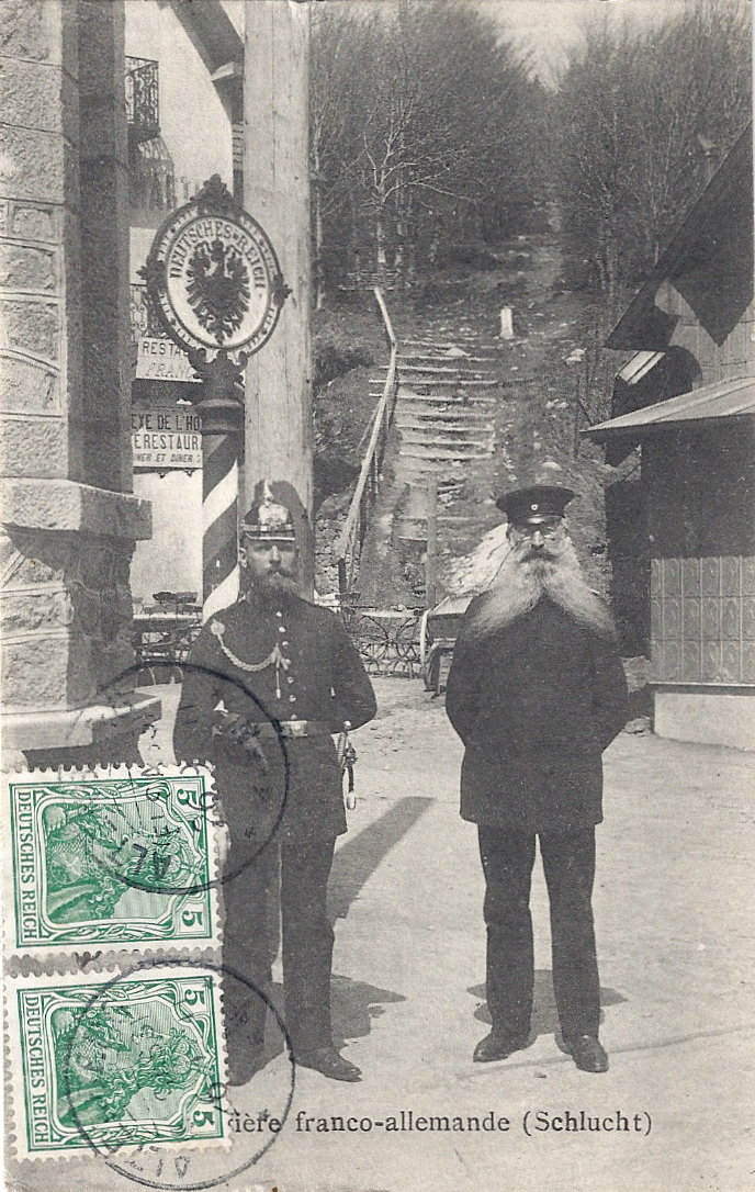
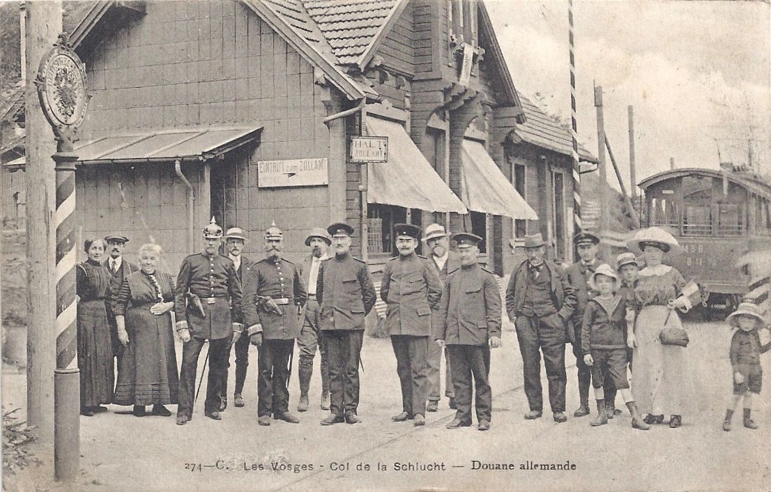
The officers in this postcard are in annexed Alsace , on German territory, standing by the frontier posts of Germany (the round plaque with the Imperial eagle) and France (the adjacent oblong plaque nearer the photographer).

Col d'Oderen posted 1906

My photos were taken on one of those stifling summer days when the tarmac had turned to liquid black stickiness, and leaving an air-conditioned car meant stepping into a daunting blast of heat. A couple of women were peacefully picnicking under the trees. Apart from that, the air was utterly still, gently muddied by the hum of bees and ripped by the raucous cackle of magpies, with the occasional plaintive wails of birds of prey soaring in the thermals. The modern départementale stone is at the site of the ancient frontier, with borne 3102 next to it.

Oderen 2 Former French side

Oderen 1 Boundary – former frontier

Oderen borne Borne 3102

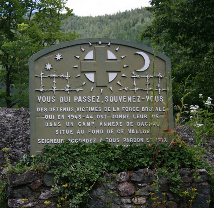
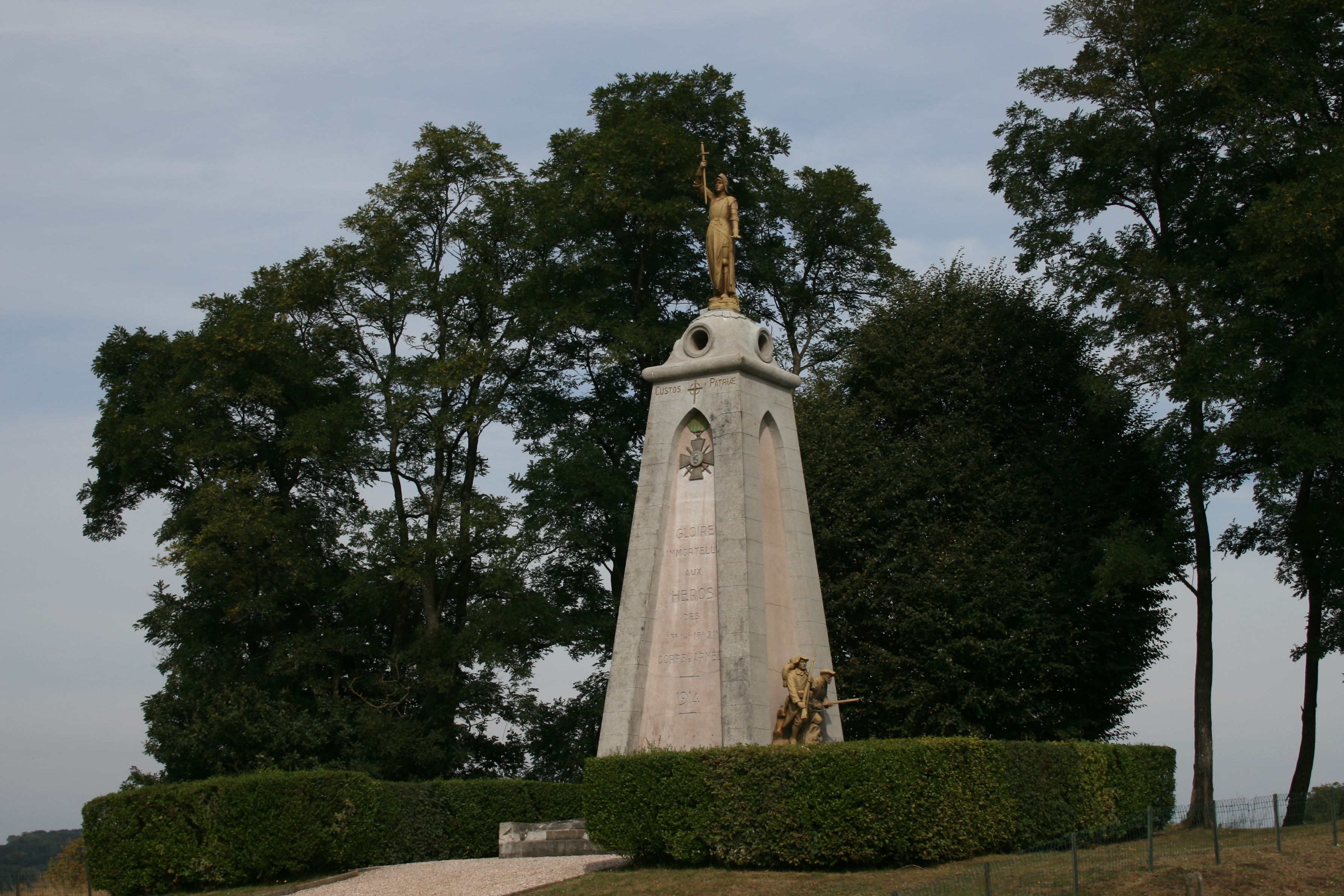
Close to the frontier is a stone monument. Its gold lettered text says:

“À la gloire des unites du groupement tactique de la 3ème D.I.A. et de son chef le Général Duval qui libérerent Ventron le 25 novembre 1944 et s’emparerent du Col d’Oderen le 1er décembre 1944 après de rudes combats.”

[la 3ème D.I.A. = 33e division d’infanterie algérienne]

This is a Second World War action. Briefly* : Alsace was again occupied by Germany. 3ème DIA pushed the enemy back from the Gérardmer area through the Vosges cols of Bussang, Oderen and Bramont, liberating various small towns and eventually reaching Colmar, thus playing an important role in facilitating the liberation of Alsace in 1945. It’s worth remembering that Vosges winters are bitter. The icy cold in 1944/5 was unbearably raw.

Col d'Oderen monument original


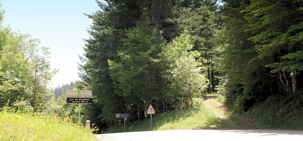
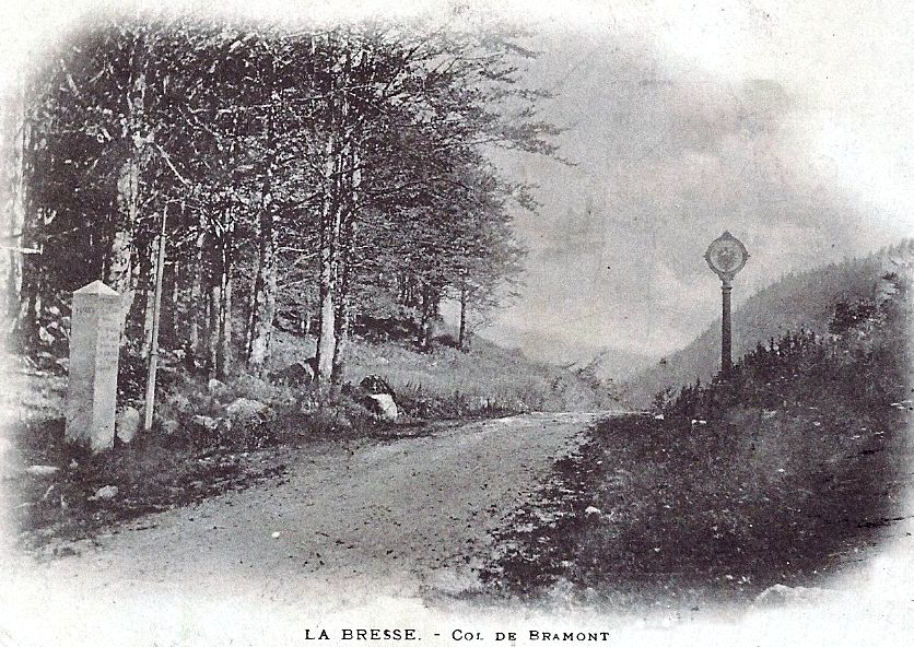
The Col de Bramont (956m) is north of the Col d’Oderen, east of the busy ski resort la Bresse and south of the popular Col de la Schlucht. It is one of the wilder of the frontier cols, and in the period when it was actively guarded, there was nothing at all there apart from a small wooden hut which provided shelter for customs officials. Consequently smuggling flourished in the area. Contemporary postcards reveal a muddy, poorly-formed road, surrounded by ferns and forest. It looks inaccessible and still is fairly difficult in places : the D-road from Wildenstein climbs a series of steep, challenging hairpin bends.

My photograph was taken looking into the former German territory from the former French side and the contemporary postcard shows the same view from the opposite side of the road. The German frontier post (with the eagle) is approximately where the départementale sign is now. The photographer was probably standing by the douaniers’ hut.


Col du Bramont looking to German side

Col de Bramont posted 1902 edited


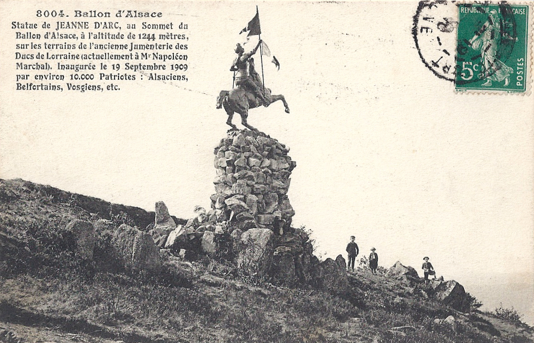
A pleasant drive or walk from the Col de Bramont is to follow the signs to Col de la Vierge and Lac des Corbeaux (via chemin Béry). The pretty lake is in a perfectly formed glacial corrie surrounded by pine forests. It’s popular for gentle pottering round the lake, strolls along shaded woodland paths, fishing and just relaxing with a picnic. Apparently the water is very cold even in summer – though swimming from the sandy beaches is officially forbidden. However, I suspect that on a future visit, the bathing costumes may well be ready in the car!

Lac des Corbeaux


All postcards and photographs my own.


*Note: further reading in English on Alsace and the Vosges in the Second World War includes:

Bonn, Keith. When the odds were even: The Vosges Mountain Campaign October 1944 – January 1945

Whiting, Charles. The Other Battle of the Bulge: Operation Northwind

Zaloga, Steven J. Operation Nordwind 1945. Hitler’s last offensive in the West


Royal travels (an occasional look at the various Kaisers’ visits to Elsaß-Lothringen*)

One of the first public buildings built by the new Reichsland authority was the fine central station in Strasbourg (1883), designed by Jacobstahl, an architect from Berlin. In the departure hall, two fabulous gold-framed murals by Knackfuss celebrated the integration of Alsace and Lorraine into the Empire while reminding the traveller of a past period of unity.

One depicted the arrival of Emperor Friedrich I Barbarossa in Haguenau in 1164, the year he awarded a city charter to this small town which he had fortified and where he had chosen to site his imperial residence. Haguenau (Hagenau in German) is north of Strasbourg. “Im alten Reich”

Visit of Kaiser Barbarossa 1164 Hagenau

The other shows Kaiser Wilhelm I and Crown Prince Friedrich arriving in Strasbourg in 1877 to inspect fortifications. “Im neuen Reich”

Visit of Kaiser & Crown Prince to Strasbourg 1877 posted 1910

(Above: Card posted April 1908. The two women in the centre welcoming him are wearing regional costumes of Alsace and Lorraine.)

The murals were an assertion of historic unity and German authority. Naturally, they were taken down when the city was restored to France and I believe they are lost. The SNCF station now includes the TGV hub.

The arrival of Kaiser Wilhelm II at a station clearly involved flags, bunting, grand motor cars and assorted worthies. Here he is making his way to a car at the station of the small wine-growing village of St-Hippolyte (St Pilt in German).

St-Hippolyte Emperor arrival at station posted Aug 1912 (Card posted August 1912)

The station is now derelict and rather intimidating with large barking dogs roaming the grounds. I photographed it almost exactly one hundred years later in July 2012.

St-Hippolyte station July 2012 35cm

The card gives no indication about where the Kaiser and his entourage were travelling to, but St-Hippolyte is very convenient for his castle, Hohkönigsburg, in French Haut-Kœnigsbourg, which overlooks St-Hippolyte and the surrounding villages and vineyards. When Kaiser Wilhelm II took ownership of Hohkönigsburg, it was in ruins after fires and failed restoration projects. The nearby town of Sélestat owned the castle but, unable to fund its reconstruction, it offered to the Kaiser in 1899.

Haut Koenigsburg Hoh-Konigsburg Hotel mit ruines (Before – castle ruin at the summit)

Haut Koenigsburg posted 1901 (Before – card posted 1901)

After:

Haut Koenigsburg posted pre WW1

The potential to restore a fabulous castle on a magnificently prominent site was irresistible and Wilhelm II embarked on an ambitious project which would signal to all that Alsace was again part of the Empire. Between 1900 and 1908 this potent political symbol was painstakingly rebuilt in the style of a fifteenth century mountain fortress. Like the station in Strasbourg, it was yet another public building powerfully reinforcing the vision of Alsace aligned within his Empire – permanently.

Today it is an immensely popular tourist attraction: vast numbers of visitors go there each year. For this reason, I have not been inside Haut-Kœnigsbourg: I consider it’s best viewed from a distance.

Haut Koenigsburg sunset 35cm (Left and below, photographed from St-Hippolyte)

Haut Koenigsburg sunset 2

Wilhelm II never lived at Haut-Kœnigsbourg: I believe he never intended to. Locally it was a much criticised symbol of distrust and dislike. Even the pageant of its official opening took place in a deluge. It was not entirely finished in his reign: within five years of its completion, the storms of war were breaking across Europe.

Lightning

( Storm, June 2012. St-Hippolyte church lit up; Haut-Kœnigsbourg on top of hill to right)

All postcards and photographs my own.

*Note: Elsaß-Lothringen – Alsace and Lorraine

More historical information on the Haut-Kœnigsbourg website: http://www.haut-koenigsbourg.fr/

Crossing the frontier by tunnel: the Col de Bussang

See d'Urbes resized

The main road between Thann and Remiremont passes the tranquil, natural lake of the See d’Urbès, where you can walk round the water’s edge and watch dragonflies darting among the marshes. You can take the little road to peaceful Storckensohn, walk past the pretty Alsacien houses and pause by the old oil mill, a watermill. I imagine that visitors from a century ago would have seen a similar scene.

Afternoon sun Urbes  –  Storckensohn. Timeless –  The oil mill, Urbes

Then you can return to the main N66 and begin the winding climb to the Col de Bussang. You pass the memorial to those whose lives ended in the Dachau satellite camp at the foot of Vallon. (It was also administratively connected to the concentration camp at Natzweiler-Struthof, 50 km SE of Strasbourg.) In 1944, the Germans requisitioned a partly complete early rail tunnel to the west of Urbès for an arms factory under the Daimler-Benz umbrella, in a scheme which was code-named KRANISCH-10. Two thousand prisoners and deportees, arriving in waves, were employed in atrocious conditions there between March and September 1944. A current project (2012-2016) aims to provide a memorial to those who worked and died there, with interpretation panels, a trail, a rose bed and art works by young people.*

Memorial

The N66 is a fast, winding road and I imagine that many drivers keen to finish the steep climb to the Col du Bussang (731m) are completely unaware that just to the north of the summit (the col) there is a tunnel through the hillside. It replaced an important road which passed above the site where the tunnel was constructed. The sign over the French entrance to the tunnel was specific: Limite de territoire français 155m de l’origine de tunnel. Shortly after entering the tunnel, the traveller was entering German territory.

Col de Bussang Côté Français

Customs and security on the other side of the tunnel were markedly different from that on the French side, in the officials’ uniforms and the language.

Col de Bussang côté de l'Alsace  Wirtschaft zum Tunnel

The tunnel was a great draw for tourists and travellers. The café was, I believe, Café Murat and postcards dated after the Great War show that ‘Wirtschaft zum Tunnel’ was promptly obliterated and replaced with ‘Café du tunnel’.

Col de Bussang Alsace side

Col de Bussang after war   Café du Tunnel

The entrance to the tunnel is still visible from the former German side (the Urbès side), but I have not been able to see any evidence of the former French entrance (the Bussang side). However, you can see the source of the great river Moselle (Mosel) as it trickles out of the hillside. (Take the D89, route des Sources, not avenue des Sources, and after passing the turning up the hill to Drumont there is a small picnic area at the source.)

Tunnel Col Urbes side (Former German side. Tunnel to the left of the picture. Modern hotel.)

These two cards demonstrate the difficulties of travelling through the Vosges in winter. Both show the French side of the frontier and the customs officials are visible in each. (The stamped card was posted in Wesserling, Alsace, German territory at that time, hence the German stamp.) The small chalet nearest the camera was built by Touring-Club.

Col de Bussang sous la Neige - La frontière en sortant du Tunnel

Col de Bussang route de Wesserling

The N66 remains an important road under pressure. In earlier centuries the route was vital for the defence of France and the movement of troops through the Vosges towards the Swiss border; now trucks are its significant load. The fast road is worth using briefly for the natural beauty on either side of the Col: from St-Maurice you can pick up the steep route to the Ballon d’Alsace , or it’s pleasant to linger in the tranquil nature reserves and lakes near Urbès and Kruth.

Window box

All postcards and photographs are my own.

• For more information please see http://www.struthof.fr/fr/nos-partenaires/memoriaux-des-camps-annexes/ and click on le Kommando Urbès. Also see http://www.lieux-insolites.fr/alsace/urbes/urbes.htm

The Kaiser’s Birthday, place Kléber, Strasbourg

January 27th, 1859 was the day the future Kaiser Wilhelm II was born.  During the occupation of Alsace, it was evidently deemed fitting that parades were held in Strasbourg to mark great events and as the central of Strasbourg’s various squares and places, place Kléber would be an obvious choice for a birthday Mass.

Place Kléber is named after General Jean-Baptiste Kléber, whose statue dominates the space. He was assassinated in Egypt in 1800, but Napoleon refused to allow his body to be brought home to his native Alsace. Eventually Philippe Glass designed a monument which was inaugurated in 1840 and Kléber’s ashes lie underneath. (1)

The Franco-Prussian War, 1870-1, brought to an end a peaceful, prosperous period for the city of Strasbourg. The inhabitants and buildings of Strasbourg suffered considerably during the war. German troops led by General von Werder intended to capture the city and France was unable to send help because of its losses at Sedan, so the small garrison at Strasbourg was effectively isolated. The city was heavily bombarded from August 1870 until it surrendered on 28th September.  President Poincaré awarded the city the Légion d’Honneur in 1919 and his speech tracing that period is reproduced in Guides Illustrées Michelin des Champs de Bataille (1914-1918) : Strasbourg (2)

This postcard artistically depicts the terrible scene. General Kléber’s statue is clearly visible among the chaos.

Strasbourg Place Kleber bombardment 1870

From then on, Strasbourg was German.  This card shows an open air service to mark the Kaiser’s birthday in January 1915. General Kléber’s snow-covered statue is surrounded by German troops. It is a massive statement of power.

Strasbourg Place Kleber Kaiser's birthday & open air service 1915

There is a certain irony and poignancy in the next two cards, both featuring the same location, place Kléber. The first shows French troops re-entering Strasbourg after the Great War. General Kléber’s statue is in the centre of the photograph.

Strasbourg Place Kleber entry of troops after War

Here is the entry of Maréchal Pétain on November 25th, 1918.

Strasbourg Place Kleber Petain troops 25.11.1918

Place Kléber seems to have changed little since that time and many visitors to Strasbourg in the Christmas period head straight to see the le Grand Sapin de Noël. (Unfortunately I didn’t capture Kléber in this photo.) Happy times.

Sapin

Peace restored to the city: place Kléber in the era of trams where the troops once stood. Kléber and the cathedral pin the view to its past while business people, shoppers and travellers pass through to their work, the great department stores and the cafés as they do today.

Strasbourg Place Kleber (Card undated)


All cards and the photo are my own.

Notes:

(1)    Information on Strasbourg’s architecture and monuments:  http://www.archi-strasbourg.org/

(2)    Guides Illustrées Michelin des Champs de Bataille (1914-1918) : Strasbourg, pp 5-7 and 8.

Jehanne d’Arc

On 30th May 1431 a young peasant girl from Domrémy in the Vosges was burned alive after an illegal trial for heresy in Rouen. During the period in which Alsace and Lorraine were annexed to the German Empire, she became a powerful symbol of resistance, of defiance, of eagerness for liberation.

Jeanne Ballon

The statue on the Ballon d’Alsace – on the French side of the hated border – of Jeanne d’Arc is still defiantly facing Germany, deliberately positioned to show that Alsace and Lorraine challenge their annexation. It was sculpted in 1909 by Mathurin and features in many postcards of the era; this one is typical and the text draws attention to the patriotic crowds at the inauguration.

Ballon d'Alsace statue de Jeanne d'arc

The inspirational figure of Jeanne is a recurrent theme in monuments and memorials after the oppression was lifted. Many Alsacien men were forced to fight for Germany, although it has to be remembered that anyone under the age of 43 when war was declared in 1914 had not known life as a French citizen and many were to all intents and purposes fully fledged Germans. Nevertheless, the theme of a young man being forced to fight for the oppressor is a powerful one and many patriotic images depict the despair of the young soldier and his family.

The mother depicted on the war memorial at Guebwiller pins a small rosette on her son’s chest under his jacket and tells him, “Remember you are French.” These rosettes were red, white and blue (the colours of the French flag). The memorial at Rosheim [below] shows a French poilu offering the open hand of friendship to a young man who has opened his jacket to reveal the patriotic rosette over his heart; his enforced pickelhaube has been discarded at his feet and Jeanne embraces the two in a gesture which emphasises the harmony and unity restored between France and her lost départements.

Rosheim Jeanne

The inspiration of Jeanne in times of oppression and war is reflected in her use in cemeteries. The village and community of Plaine, north of Saales, suffered dreadfully in the raging combats of 1914 as each side fought to gain control of the essential cols and the front moved rapidly. Jeanne was erected in this cemetery on 12th August 1923. The base of the statue says, “À eux l’immortalité, à nous le souvenir.”

Plaine cimetière militaire

In 2012. (There are British aviators and Muslim casualties among the graves.)

Plaine Jeanne

Menil-sur-Belvitte is a large 1917 nécropole nationale south of Baccarat and it is the resting place of a thousand men, many casualties from the Bataille de la Mortagne (1914) and the ghastly fighting at Col de la Chipote. Opposite the cemetery, peacefully surrounded by pastures with the characteristic Vosgienne cows, is a memorial privately erected in 1927 by l’Abbé Collé, the village curé. He also established a small commemorative museum which was destroyed by German troops in 1944.

Menil Jeanne

The essential figures on this memorial are in gold; one is Jeanne (“custos patriae”) at the pinnacle and the others (in what seems like slightly toned down gold) are the brave heroes of the 13th, 14th  15th  and 21st Corps d’Armée 1914.

Jeanne Menil Jeanne 2

It is a memorial of unexpected height and power; the loyal Chasseur figures, bravely ready for any challenger and in death cared for by a despairing figure of Mary, demand attention. Jeanne’s immense elevation, her raised cruciform sword and her striking gold armour communicate as a symbol of defiance and inner strength even today. Your eye is drawn upwards from the brave soldiers to their alleged inspiration as they fought to regain Alsace and Moselle for France.

Note. Published to mark the feast day of Ste Jeanne d’Arc, 30th May 2013.

More interesting material on Jehanne here: http://www.maidofheaven.com/ and http://mrssymbols.blogspot.co.uk/2012/12/arms-and-maiden.html

Crossing the frontier before the Great War – the Cols

 Rainbow over Reichackerkopf

(Rainbow over Reichackerkopf, 1915 battleground. The valley rises eventually to Col de la Schlucht, to right of photograph, off scene)

The landcape of the Vosges is mountainous and very beautiful; it forms deceptively rounded peaks rising to a series of summits called les Ballons. West of Thann, the Ballon d’Alsace is 1247 metres (4091 feet) and the Ballon d’Servance is 1216 metres. The Grand Ballon, west of Guebwiller, is 1424 metres (4672 feet). Le Hohneck, west of Munster, is 1363 metres (4472 feet).

It’s an exceptional area. The wild, silent forests with towering pines, still mysterious pools where dragonflies hover in summer, high open pastures of the Hautes Vosges dotted with the distinctive Vosgienne cows, waterfalls, peaty bogs and meadows of mountain flowers are a natural habitat for diverse wildlife. In May, after six months of safe confinement down in the lower farms, humans herd the cows up into the high mountain pastures where they run with their new freedom in a cacophony of hundreds of cow bells: transhumance is a cause for celebration and festivity. The mountain products are sought after and relished: cheese, hams, honey, kirsch. Alsace wine is very special. Biodiversity flourishes even in sites ravaged by war. People come to the Vosges to walk, ski, drive, cycle; to examine flora and fauna; to investigate rocks and minerals; to eat well or stay in peace; to buy produce to take home; to enjoy the hot brightness and the mountain air after the humidity of the Rhine plain in summer, or to have fun in the deep snows. It was equally a source of pleasure, exploration and challenge before the Great War.

Ballon d'Alsace La Borne et le Sommet (cars)

Access through the Vosges is historically through a series of cols. When Alsace and Moselle became the newly-named Reichsland Elsaß Lothringen, the cols ceased to be the passages from one department to another: they became the legal crossing from one state to another. Travellers and tourists still visited the Vosges and they crossed the frontier with a mixture of bewilderment, curiosity, anger, despair, sadness and astonishment, evidenced by the thousands of postcards on sale and their poignant hand-written messages.

Patriotic cards showing the return of Alsace and Lorraine to France were popular before and during the Great War, then sent by soldiers who perhaps didn’t wish to depict the awful scenes they witnessed, or perhaps written by senders who wished to encourage and motivate. Some of the minor cols were heavily fought over because of their strategic importance: Col de la Chipotte (south west of Raon l’Étape) is less famous than the well-known sites such as le Linge and le Vieil-Armand / Hartmannswillerkopf but the human suffering and loss on both sides there in August-September 1914 was appalling.

 Patriotique l'Arrivée des Diables Bleus

(Card posted 1915. The woman on the left wearing a black coiffe represents Alsace, the one on the right Lorraine.)

The map shows the main cols in the Vosges, approximately marked. I’ve also included the summits of the Ballon d’Alsace and Hohneck. North of the map area were the cols of Donon (west of Molsheim) and Hantz (west of Barr). I will feature each of the cols in forthcoming individual pieces. They are all worthy of special attention!

 Cols on map

I intend to write a lot more about the Vosges themselves later in the blog. For the meantime, there’s an interactive map here: http://www.parc-ballons-vosges.fr/la-carte-du-parc/

A tale of two posts: les poteaux sur les frontières

After the establishment of the new German state, it was essential for the German authorities to indicate the new boundaries as quickly as possible. At each of the crossing points through the Vosges mountains, they erected wooden posts painted in the German colours. But soon it was obvious that these were susceptible to the extreme weather variations and to vandalism.

By contrast, and probably understandably, the French authorities were rather slow in marking the hated frontier and eventually, in 1885, the German ambassador had to intervene and insist that the work was carried out, arguing that there were risks to France in not indicating the border. A survey was carried out to evaluate the problem and twelve crossing points were identified. Reluctantly, the French agreed to erect their own posts. The Ministry of the Interior made a grant available to fund ten posts at the most important crossings and they were ordered in July, 1886, from a foundry in St-Dié. The Ministry of Public Works funded two more, one at the Col de Ste-Marie between St-Dié and Sélestat and one at the Col du Bussang north of the Ballon d’Alsace. They were in place by the end of 1886. Painting them was considered too expensive.

 Col de Ste-Marie & borne before War written 1918

(Col de Ste-Marie. Borne centre, poteau to right)

Of course, they soon began to deteriorate. Newspapers began to complain about the shameful lack of maintenance of the national symbol, comparing them to the pristine condition of the German markers. Meanwhile the foundries of Kaiserslautern were busy making imposing plaques declaring to all travellers that they were entering the German Empire. From 1889, these were in place, dominating the less cared-for French markers, often mounted on striped posts in the Empire’s colours.

Col de la Schlucht frontiere franco-allemande 1911 2 people

(Col de la Schlucht, German and French customs officials)

Col de la Schlucht German customs, tram

 (Col de la Schlucht. Tram arrival, poteau to left.)

Many cards and pictures show the joyful destruction of these loathed posts in the early days of the Great War and many messages declare the writer’s pleasure in …

 Col de la Schlucht plus de frontiere

… ‘Plus de frontière!’

(Above: Col de la Schlucht, deserted customs building. The Hotel Français was destroyed during the Great War. More of that anon.)

A few words about bornes

Image

The Col du Bonhomme has been a route through the Vosges for centuries. It’s at the point where the main road from Nancy and St-Dié to Colmar crosses the Route des Crêtes, which was established in the Great War as a route along the ridge of the Vosges for the easier movement of French troops. It used to look like the card below posted in 1913 shows. As a border crossing between annexed Alsace and the rest of France, it was patrolled by customs officials and the frontier was marked with a metal plaque on a striped post: a poteau frontière.

Image

Behind the hotel at the left hand side of the picture, there are now woods, with footpaths tracking through. Before long, you come across stones set at intervals, like these two:

 Image

On closer examination, it’s clear that these are the original bornes frontières (frontier stones). The smaller, more rugged one was a rudimentary interim measure while the occupying forces of the German Empire had marked stones made. I think these date from the mid-1890s. The bornes were numbered and on this one it’s possible – just – to distinguish the number 207*.

 Image

Bornes marked the frontier at crossing points, at cols, across meadows and across high pastures (chaumes),  from the border with Luxembourg to the border with Switzerland. From Luxembourg to Donon they were the responsibility of the German authorities and France was responsible for the rest.  Originally the stones were not very visible and thus easily damaged by passing vehicles, or by disgruntled locals, so the bornes considered most at risk from traffic damage were painted white.

The original bornes were supposed to be just over a metre tall at the front with a face about 30cm across, with a base sunk into the ground to about 60 cm. They were lettered D (Deutschland) and F (France) and they carried their identification number. (It is often possible to distinguish the letters on the  bornes which remain.) Given the length of the new frontier, the necessity of marking it quickly and the difficulties imposed by the mountainous terrain, some were less well executed than others.

This borne is at the Col de Ste-Marie.

 Image

 Card posted before the Great War:

 Image

Tourists and travellers sent thousands of postcards showing the new controversial frontier posts. Their photos and messages evoke an era of longing and, as a visitor wrote to her cousin on a card I possess (translated):

 “So many regrets in these few words! Our Alsace. So close to us yet no longer of us!


Debout les Morts!

Bringing the French experience of the First World War on the Western Front to English language speakers

WW1 Revisited

A Great War Journey with Paul Reed

Lordynges, Lystenyth

Children's stories lovingly adapted into Middle English verse by Hollie L. S. Morgan

midasinreverse: ian o'brien

Poetry, thoughts, rants by @OB1Ian

In That Rich Earth...

Great War History - reviews & articles

Expériences étrangères

Expériences étrangères

WW1 Centenary

Great War Centenary 2014-2018 website by Paul Reed

halfmuffled

Looking at the members of the Surrey Association of Church Bell Ringers who served in the First World War, and closely related matters

Blindfold and Alone

The trials of British Soldiers convicted in Capital Courts Martial during the Great War

%d bloggers like this: