A tale of two posts: les poteaux sur les frontières

After the establishment of the new German state, it was essential for the German authorities to indicate the new boundaries as quickly as possible. At each of the crossing points through the Vosges mountains, they erected wooden posts painted in the German colours. But soon it was obvious that these were susceptible to the extreme weather variations and to vandalism.

By contrast, and probably understandably, the French authorities were rather slow in marking the hated frontier and eventually, in 1885, the German ambassador had to intervene and insist that the work was carried out, arguing that there were risks to France in not indicating the border. A survey was carried out to evaluate the problem and twelve crossing points were identified. Reluctantly, the French agreed to erect their own posts. The Ministry of the Interior made a grant available to fund ten posts at the most important crossings and they were ordered in July, 1886, from a foundry in St-Dié. The Ministry of Public Works funded two more, one at the Col de Ste-Marie between St-Dié and Sélestat and one at the Col du Bussang north of the Ballon d’Alsace. They were in place by the end of 1886. Painting them was considered too expensive.

 Col de Ste-Marie & borne before War written 1918

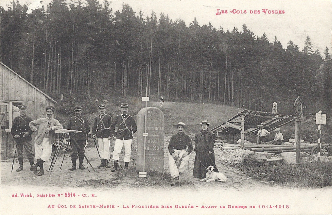
(Col de Ste-Marie. Borne centre, poteau to right)

Of course, they soon began to deteriorate. Newspapers began to complain about the shameful lack of maintenance of the national symbol, comparing them to the pristine condition of the German markers. Meanwhile the foundries of Kaiserslautern were busy making imposing plaques declaring to all travellers that they were entering the German Empire. From 1889, these were in place, dominating the less cared-for French markers, often mounted on striped posts in the Empire’s colours.

Col de la Schlucht frontiere franco-allemande 1911 2 people

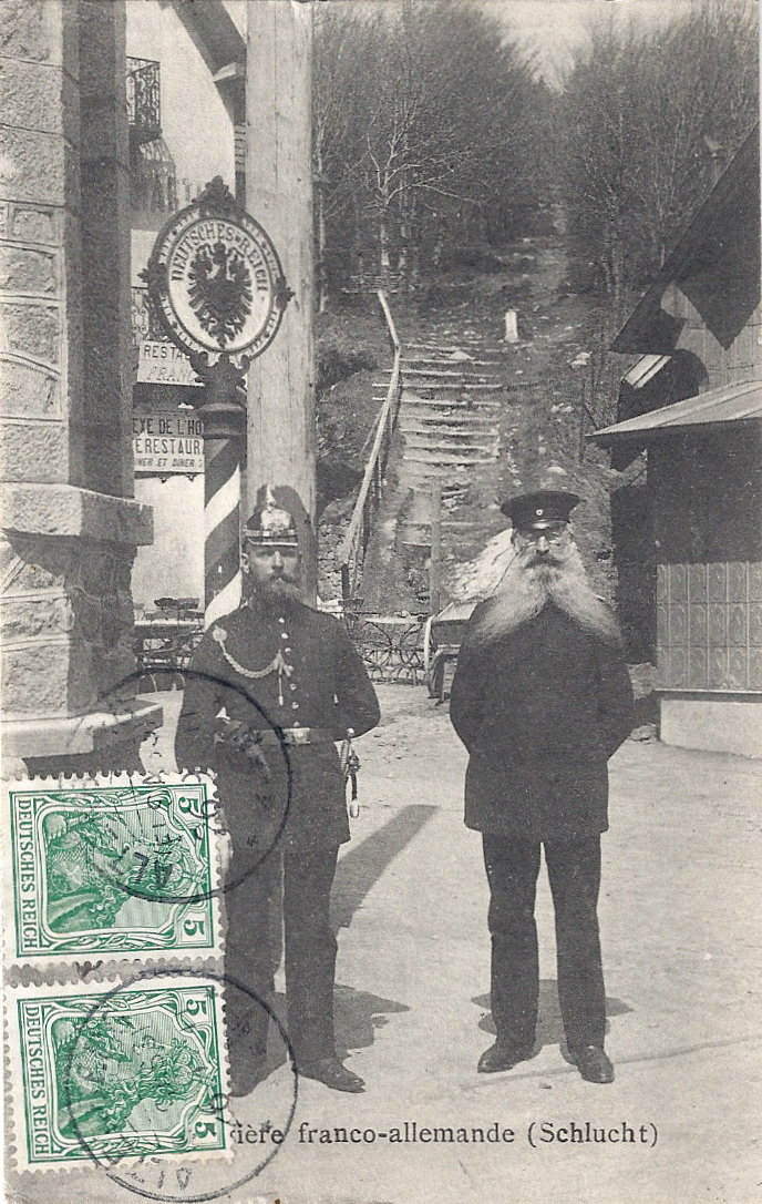
(Col de la Schlucht, German and French customs officials)

Col de la Schlucht German customs, tram

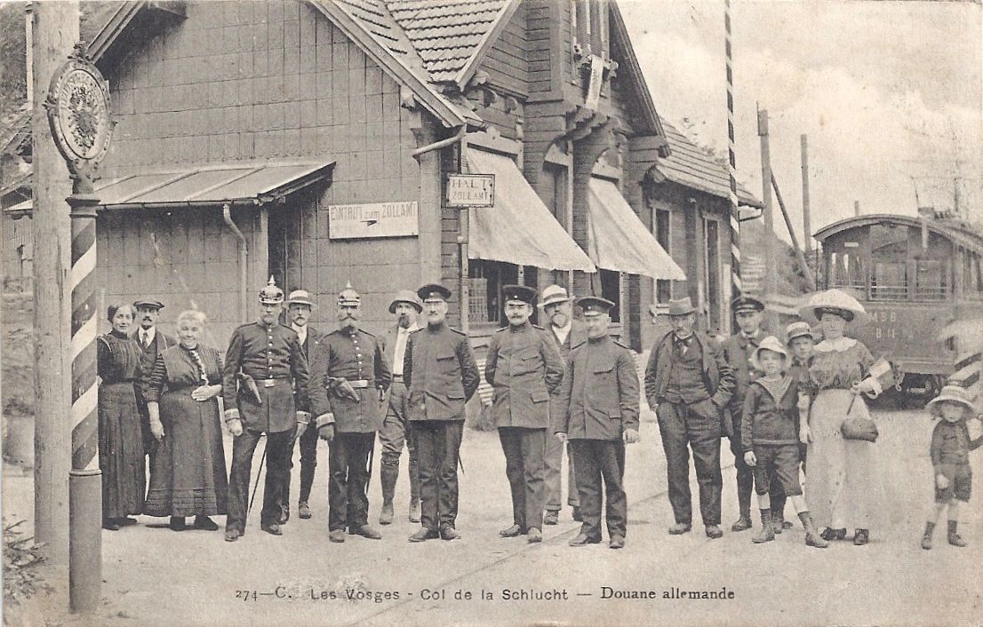
 (Col de la Schlucht. Tram arrival, poteau to left.)

Many cards and pictures show the joyful destruction of these loathed posts in the early days of the Great War and many messages declare the writer’s pleasure in …

 Col de la Schlucht plus de frontiere

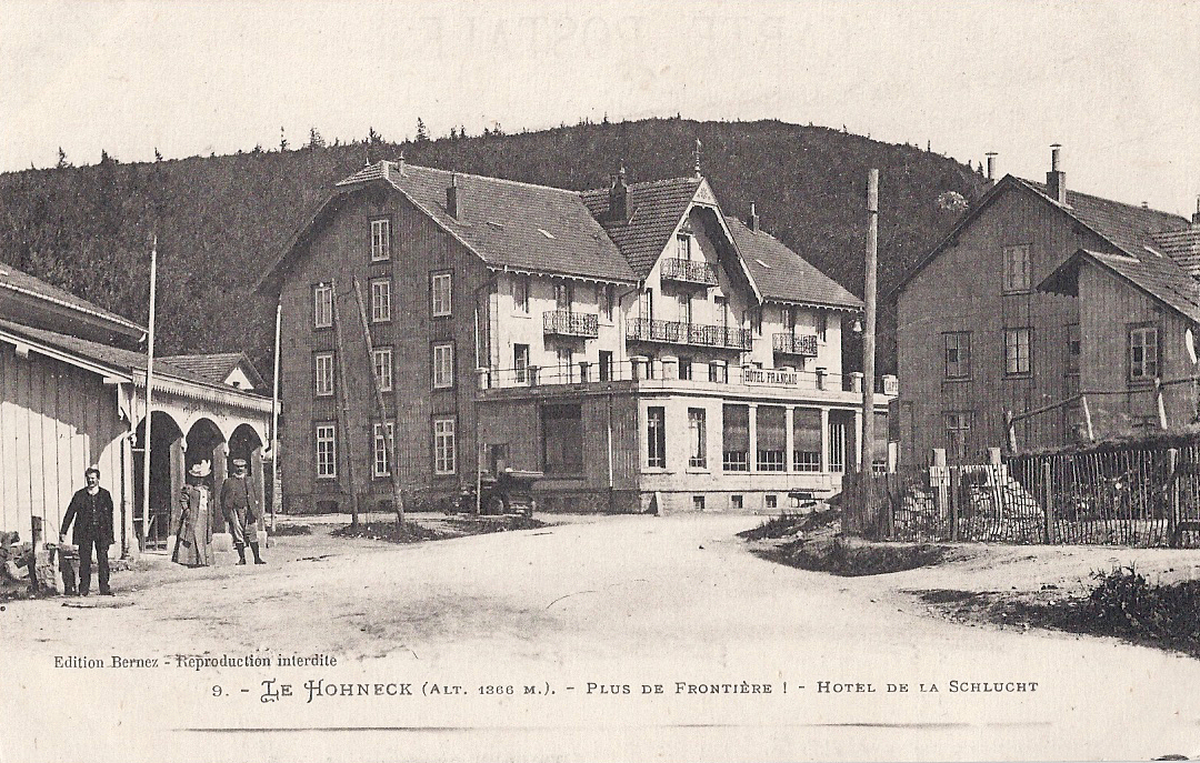
… ‘Plus de frontière!’

(Above: Col de la Schlucht, deserted customs building. The Hotel Français was destroyed during the Great War. More of that anon.)

A few words about bornes

Image

The Col du Bonhomme has been a route through the Vosges for centuries. It’s at the point where the main road from Nancy and St-Dié to Colmar crosses the Route des Crêtes, which was established in the Great War as a route along the ridge of the Vosges for the easier movement of French troops. It used to look like the card below posted in 1913 shows. As a border crossing between annexed Alsace and the rest of France, it was patrolled by customs officials and the frontier was marked with a metal plaque on a striped post: a poteau frontière.

Image

Behind the hotel at the left hand side of the picture, there are now woods, with footpaths tracking through. Before long, you come across stones set at intervals, like these two:

 Image

On closer examination, it’s clear that these are the original bornes frontières (frontier stones). The smaller, more rugged one was a rudimentary interim measure while the occupying forces of the German Empire had marked stones made. I think these date from the mid-1890s. The bornes were numbered and on this one it’s possible – just – to distinguish the number 207*.

 Image

Bornes marked the frontier at crossing points, at cols, across meadows and across high pastures (chaumes),  from the border with Luxembourg to the border with Switzerland. From Luxembourg to Donon they were the responsibility of the German authorities and France was responsible for the rest.  Originally the stones were not very visible and thus easily damaged by passing vehicles, or by disgruntled locals, so the bornes considered most at risk from traffic damage were painted white.

The original bornes were supposed to be just over a metre tall at the front with a face about 30cm across, with a base sunk into the ground to about 60 cm. They were lettered D (Deutschland) and F (France) and they carried their identification number. (It is often possible to distinguish the letters on the  bornes which remain.) Given the length of the new frontier, the necessity of marking it quickly and the difficulties imposed by the mountainous terrain, some were less well executed than others.

This borne is at the Col de Ste-Marie.

 Image

 Card posted before the Great War:

 Image

Tourists and travellers sent thousands of postcards showing the new controversial frontier posts. Their photos and messages evoke an era of longing and, as a visitor wrote to her cousin on a card I possess (translated):

 “So many regrets in these few words! Our Alsace. So close to us yet no longer of us!


Debout les Morts!

Bringing the French experience of the First World War on the Western Front to English language speakers

WW1 Revisited

A Great War Journey with Paul Reed

Lordynges, Lystenyth

Children's stories lovingly adapted into Middle English verse by Hollie L. S. Morgan

midasinreverse: ian o'brien

Poetry, thoughts, rants by @OB1Ian

In That Rich Earth...

Great War History - reviews & articles

Expériences étrangères

Expériences étrangères

WW1 Centenary

Great War Centenary 2014-2018 website by Paul Reed

halfmuffled

Looking at the members of the Surrey Association of Church Bell Ringers who served in the First World War, and closely related matters

Blindfold and Alone

The trials of British Soldiers convicted in Capital Courts Martial during the Great War

%d bloggers like this: